IMAGES TAKEN NEAR TO
Broombank Road, CHESTERFIELD, S41 9QJ
Introduction
This page details the photographs taken nearby to Broombank Road, S41 9QJ by members of the Geograph project.
The Geograph project started in 2005 with the aim of publishing, organising and preserving representative images for every square kilometre of Great Britain, Ireland and the Isle of Man.

There are currently over 7.5m images from over14,400 individuals and you can help contribute to the project by visiting https://www.geograph.org.uk
Image Map
Images are licensed for reuse under creativecommons.org/licenses/by-sa/2.0
Notes
- Clicking on the map will re-center to the selected point.
- The higher the marker number, the further away the image location is from the centre of the postcode.
Image Listing (9 Images Found)
Images are licensed for reuse under creativecommons.org/licenses/by-sa/2.0
Image
Details
Distance
1
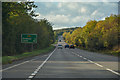
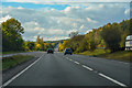
Chesterfield : The A61 Unstone-Dronfield By-Pass
Heading along the A61 out from Chesterfield.
Image: © Lewis Clarke
Taken: 30 Sep 2018
0.13 miles
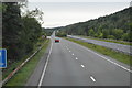
2
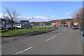
Trading Estate
Chesterfield Trading Estate accounts for half of this grid square. The hills in the distance lie just south of Dronfield with the A61 climbing up from Chesterfield. Image
Image: © Michael Patterson
Taken: 14 Feb 2006
0.17 miles
3
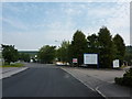
Carrwood Industrial Estate, Chesterfield
Saturday morning, not much happening.
Image: © Peter Barr
Taken: 5 Jun 2010
0.17 miles
4
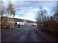
Broombank Road on Sheepbridge Trading Estate
Barlow Brook crosses beneath the road here. I was attempting to follow the footpath along the brook to the A61 using a Green Pathfinder (761) map from 1987 but the industrial estate has expanded considerably since then and the path has been truncated a few hundred metres downstream.
Image: © Jonathan Clitheroe
Taken: 27 Nov 2011
0.17 miles
5
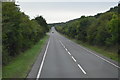
Chesterfield : The A61 Unstone-Dronfield By-Pass
Heading along the A61 through Chesterfield.
Image: © Lewis Clarke
Taken: 30 Sep 2018
0.21 miles
6
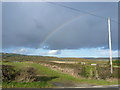
Dunston Road (B6050)
Looking across open countryside, with a clear view of a rainbow.
Image: © Alan Heardman
Taken: 29 Oct 2007
0.22 miles
9
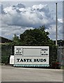
"Taste Buds" catering unit
At Sheepbridge Trading Estate
Image: © Neil Theasby
Taken: 17 Jul 2020
0.24 miles