IMAGES TAKEN NEAR TO
Ormsby Road, CHESTERFIELD, S41 8SA
Introduction
This page details the photographs taken nearby to Ormsby Road, S41 8SA by members of the Geograph project.
The Geograph project started in 2005 with the aim of publishing, organising and preserving representative images for every square kilometre of Great Britain, Ireland and the Isle of Man.

There are currently over 7.5m images from over14,400 individuals and you can help contribute to the project by visiting https://www.geograph.org.uk
Image Map
Images are licensed for reuse under creativecommons.org/licenses/by-sa/2.0
Notes
- Clicking on the map will re-center to the selected point.
- The higher the marker number, the further away the image location is from the centre of the postcode.
Image Listing (23 Images Found)
Images are licensed for reuse under creativecommons.org/licenses/by-sa/2.0
Image
Details
Distance
1
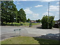
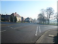
Recreation ground at Stand Road, Chesterfield
Image: © Peter Barr
Taken: 28 Jun 2010
0.04 miles
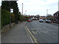
9
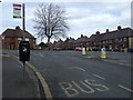
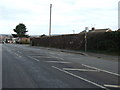
Bus stop on Peveril Road, Newbold
Outside the Cricketers Inn public house.
Image: © JThomas
Taken: 7 Mar 2015
0.15 miles
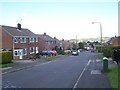
10
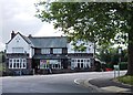
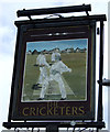
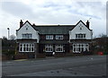
"The Cricketers", Stand Road, Chesterfield
Image: © Neil Theasby
Taken: 4 Jul 2013
0.16 miles