IMAGES TAKEN NEAR TO
Acres View Close, CHESTERFIELD, S41 8BH
Introduction
This page details the photographs taken nearby to Acres View Close, S41 8BH by members of the Geograph project.
The Geograph project started in 2005 with the aim of publishing, organising and preserving representative images for every square kilometre of Great Britain, Ireland and the Isle of Man.

There are currently over 7.5m images from over14,400 individuals and you can help contribute to the project by visiting https://www.geograph.org.uk
Image Map
Images are licensed for reuse under creativecommons.org/licenses/by-sa/2.0
Notes
- Clicking on the map will re-center to the selected point.
- The higher the marker number, the further away the image location is from the centre of the postcode.
Image Listing (14 Images Found)
Images are licensed for reuse under creativecommons.org/licenses/by-sa/2.0
Image
Details
Distance
1
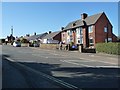
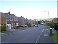
Houses on the north side of Highfield Lane
Chesterfield's northern suburbs
Image: © Christine Johnstone
Taken: 18 Oct 2018
0.07 miles
8
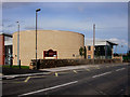
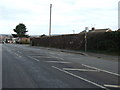
Newbold Community School
This new school was only opened this year (2006) and replaced 2 older schools which have been demolished.
Image: © Roger Temple
Taken: 1 Oct 2006
0.15 miles
9
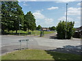
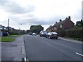
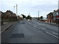
Recreation ground at Stand Road, Chesterfield
Image: © Peter Barr
Taken: 28 Jun 2010
0.17 miles
10
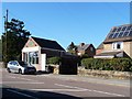
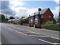
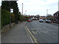
Dottie's Cafe, Highfield Lane, Newbold, Chesterfield
Convenient for students at the nearby secondary school.
Image: © Christine Johnstone
Taken: 18 Oct 2018
0.20 miles