IMAGES TAKEN NEAR TO
Rose Garth Close, CHESTERFIELD, S41 0GE
Introduction
This page details the photographs taken nearby to Rose Garth Close, S41 0GE by members of the Geograph project.
The Geograph project started in 2005 with the aim of publishing, organising and preserving representative images for every square kilometre of Great Britain, Ireland and the Isle of Man.

There are currently over 7.5m images from over14,400 individuals and you can help contribute to the project by visiting https://www.geograph.org.uk
Image Map
Images are licensed for reuse under creativecommons.org/licenses/by-sa/2.0
Notes
- Clicking on the map will re-center to the selected point.
- The higher the marker number, the further away the image location is from the centre of the postcode.
Image Listing (13 Images Found)
Images are licensed for reuse under creativecommons.org/licenses/by-sa/2.0
Image
Details
Distance
1
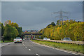
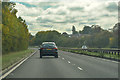
A617 approaching Chesterfield
From a long lay-by looking north-west down the hill towards the town centre behind the St Leonards Drive bridge.
Image: © Trevor Rickard
Taken: 26 Feb 2011
0.13 miles
2
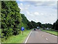
Chesterfield : The A617
Looking along the A617 as it heads into Chesterfield.
Image: © Lewis Clarke
Taken: 30 Sep 2018
0.14 miles
3
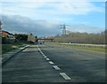
A617 near Hasland
On leaving Chesterfield, the A617 is dual carriageway towards the M1 motorway.
Image: © David Dixon
Taken: 4 Aug 2014
0.15 miles
4
Chesterfield : The A617
Heading out of Chesterfield on the A617.
Image: © Lewis Clarke
Taken: 2 Oct 2018
0.18 miles
5
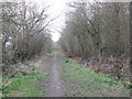
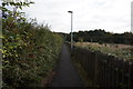
Footpath along the former railway at Spital
Image: © John Slater
Taken: 22 Mar 2016
0.19 miles
6
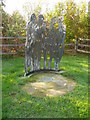
Spital Lane Artwork - Solidarity by Hilary Cartmel 1999
This work was sponsored by Persimmon Homes (North Midlands Lit), with design input from GCSE students at Hasland Hall Community School and year 5 and 6 students at Hady Primary School and commissioned by Chesterfield Borough Council as part of its percent for Art programme.
Image: © Alan Heardman
Taken: 23 Oct 2007
0.20 miles
7
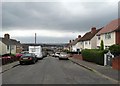
Alexandra Road East, Spital, Chesterfield
Image: © Neil Theasby
Taken: 30 Jul 2014
0.20 miles
8
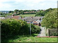
Footpath above Hartington Road
At the edge of a small area of steep streets. The path right goes to Hady Lane past the school.
Image: © Andrew Hill
Taken: 20 Jun 2011
0.23 miles