IMAGES TAKEN NEAR TO
Compton Street, CHESTERFIELD, S40 4TB
Introduction
This page details the photographs taken nearby to Compton Street, S40 4TB by members of the Geograph project.
The Geograph project started in 2005 with the aim of publishing, organising and preserving representative images for every square kilometre of Great Britain, Ireland and the Isle of Man.

There are currently over 7.5m images from over14,400 individuals and you can help contribute to the project by visiting https://www.geograph.org.uk
Image Map
Images are licensed for reuse under creativecommons.org/licenses/by-sa/2.0
Notes
- Clicking on the map will re-center to the selected point.
- The higher the marker number, the further away the image location is from the centre of the postcode.
Image Listing (64 Images Found)
Images are licensed for reuse under creativecommons.org/licenses/by-sa/2.0
Image
Details
Distance
1
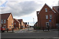
Modern housing of Spire Heights at Cross Road junction
Ordnance Survey records show that in 1961 there was a benchmark levelled at 110.030m above Newlyn Datum on the wall of Chesterfield Football Club's stadium here. The club moved to a new stadium in 2011 making way for the site to be redeveloped.
Image: © Roger Templeman
Taken: 8 Sep 2019
0.04 miles
2

View from the kop, Saltergate, Chesterfield
No longer possible to take this photo as the ground, one of the oldest in the football league, closed at the end of the 2009/10 season.
Image: © Graham Hogg
Taken: 26 Aug 2009
0.06 miles
3
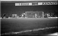
The home end at Saltergate
Chesterfield F.C. played their last game at Saltergate in May 2010.
Image: © Steve Daniels
Taken: 7 Nov 1981
0.07 miles
4
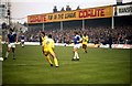
Saltergate - The former home of Chesterfield FC
Image: © Steve Daniels
Taken: 7 Nov 1981
0.07 miles
5
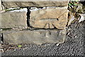
Benchmark on wall opposite #10 Compton Street
Ordnance Survey cut mark benchmark levelled at 106.370m above Newlyn Datum in 1961
Image: © Roger Templeman
Taken: 27 Feb 2020
0.08 miles
6
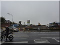
House building, Saltergate
At the junction with Compton Street.
Image: © Peter Barr
Taken: 22 Oct 2012
0.09 miles
7
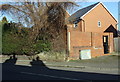
Stone wall and electricity substation enclosure on east side of Compton Street
There is an OS benchmark Image on the right hand end of the stone wall, in the middle of the image
Image: © Roger Templeman
Taken: 27 Feb 2020
0.09 miles
8
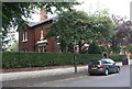
No. 16 Gladstone Road ('Russell House')
Ordnance Survey records indicate that a benchmark levelled at 109.770m above Newlyn Datum was present on the wall in 1961. The bottom section of the wall is pebbledashed with 3 brick courses added above resulting in the possible loss of the mark.
Image: © Roger Templeman
Taken: 8 Sep 2019
0.09 miles
9
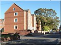
New flats, Fairfield Road, Chesterfield
On the north side of Ashgate Road.
Image: © Christine Johnstone
Taken: 18 Oct 2018
0.10 miles