IMAGES TAKEN NEAR TO
St. Andrews Rise, CHESTERFIELD, S40 3NJ
Introduction
This page details the photographs taken nearby to St. Andrews Rise, S40 3NJ by members of the Geograph project.
The Geograph project started in 2005 with the aim of publishing, organising and preserving representative images for every square kilometre of Great Britain, Ireland and the Isle of Man.

There are currently over 7.5m images from over14,400 individuals and you can help contribute to the project by visiting https://www.geograph.org.uk
Image Map
Images are licensed for reuse under creativecommons.org/licenses/by-sa/2.0
Notes
- Clicking on the map will re-center to the selected point.
- The higher the marker number, the further away the image location is from the centre of the postcode.
Image Listing (17 Images Found)
Images are licensed for reuse under creativecommons.org/licenses/by-sa/2.0
Image
Details
Distance
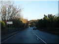
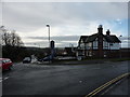
4
Matlock Road heading towards Chesterfield
Passing through the suburb of Walton, most of which is to the left. A footpath which predates most of the housing crosses at this point.
Image: © Bill Boaden
Taken: 6 Aug 2021
0.18 miles

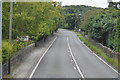
7
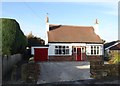
House on Foljambe Avenue, Walton, Chesterfield
Image: © Neil Theasby
Taken: 26 Nov 2013
0.20 miles
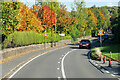
10
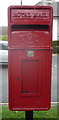
Close up, Elizabeth II postbox on Foljambe Avenue
See Image] for wider view.
Image: © JThomas
Taken: 28 Jul 2016
0.20 miles