1
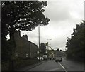
The A628 Manchester Road in Millhouse Green
Image: © Humphrey Bolton
Taken: 16 Jul 2020
0.06 miles
2
Millhouse Green from Hartcliff Hill
A view of the village from the hill to the south
Image: © Andrew Hill
Taken: 31 Jul 2013
0.08 miles
3
The Blacksmiths Arms, Millhouse Green
Image: © John Slater
Taken: 17 Aug 2013
0.10 miles
4
The Blacksmith's Arms, Millhouse Green
Named on the 1850 six-inch map.
Image: © Humphrey Bolton
Taken: 16 Jul 2020
0.11 miles
5
Thurlstone School Board 1878
The stone plaque in the left-hand wing of this Victorian primary school at Millhouse Green, tells us that it was inaugurated by Thurlstone School Board in 1878.
Image: © Roger May
Taken: 22 Jan 2006
0.13 miles
6
Towards Millhouse Green from High Bank Lane
Image: © Chris Wimbush
Taken: 18 Jun 2011
0.15 miles
7
Footpath towards Millhouse Green
Image: © Chris Wimbush
Taken: 18 Jun 2011
0.16 miles
8
Telephone Line Repairs
Telephone line repairs on the A628 near Millhouse Green.
Image: © Darren Haddock
Taken: 19 Oct 2006
0.18 miles
9
Old Milestone by the A628, Manchester Road, Millhouse Green
Carved stone post by the A628, in parish of PENISTONE (BARNSLEY District), Manchester Road, Millhouse Green, opposite No. 351, West of junction with B6106, in narrow verge, against stone wall, on South side of road. Erected by the Doncaster & Salter's Brook turnpike trust in the 18th century. Defaced.
Inscription once reads:-
(Barnsley)
(9) Miles
(Manchester)
(27) Miles
Grade II Listed. List Entry Number: 1151826
https://historicengland.org.uk/listing/the-list/list-entry/1151826
Milestone Society National ID: YS_BNMC09.
Image: © C Minto
Taken: 1 Mar 1993
0.18 miles
10
Above the houses of Millhouse green.
View from the High bank path.
Image: © steven ruffles
Taken: 27 Dec 2014
0.18 miles


