
IMAGES TAKEN NEAR TO
Kennedy Close, SHEFFIELD, S36 9NL
Introduction
This page details the photographs taken nearby to Kennedy Close, S36 9NL by members of the Geograph project.
The Geograph project started in 2005 with the aim of publishing, organising and preserving representative images for every square kilometre of Great Britain, Ireland and the Isle of Man.

There are currently over 7.5m images from over14,400 individuals and you can help contribute to the project by visiting https://www.geograph.org.uk
Image Map
Images are licensed for reuse under creativecommons.org/licenses/by-sa/2.0
Notes
- Clicking on the map will re-center to the selected point.
- The higher the marker number, the further away the image location is from the centre of the postcode.
Image Listing (16 Images Found)
Images are licensed for reuse under creativecommons.org/licenses/by-sa/2.0
Image
Details
Distance
2
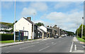
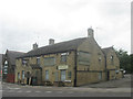
The A628 Manchester Road in Millhouse Green
Image: © Humphrey Bolton
Taken: 16 Jul 2020
0.10 miles
3
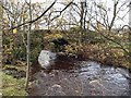
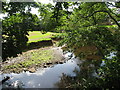
Bridge over the River Don near Millhouse Green
Image: © Steve Fareham
Taken: 15 Nov 2008
0.10 miles
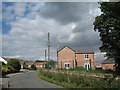
7
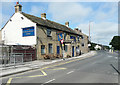
The Blacksmith's Arms, Millhouse Green
Named on the 1850 six-inch map.
Image: © Humphrey Bolton
Taken: 16 Jul 2020
0.12 miles
8
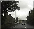
Telephone Line Repairs
Telephone line repairs on the A628 near Millhouse Green.
Image: © Darren Haddock
Taken: 19 Oct 2006
0.13 miles
9
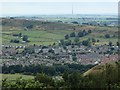
Millhouse Green from Hartcliff Hill
A view of the village from the hill to the south
Image: © Andrew Hill
Taken: 31 Jul 2013
0.13 miles
10
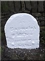
Old Milestone by the A628, Manchester Road, Millhouse Green
Carved stone post by the A628, in parish of PENISTONE (BARNSLEY District), Manchester Road, Millhouse Green, opposite No. 351, West of junction with B6106, in narrow verge, against stone wall, on South side of road. Erected by the Doncaster & Salter's Brook turnpike trust in the 18th century. Defaced.
Inscription once reads:-
(Barnsley)
(9) Miles
(Manchester)
(27) Miles
Grade II Listed. List Entry Number: 1151826
https://historicengland.org.uk/listing/the-list/list-entry/1151826
Milestone Society National ID: YS_BNMC09.
Image: © C Minto
Taken: 1 Mar 1993
0.15 miles