IMAGES TAKEN NEAR TO
Brockholes Lane, SHEFFIELD, S36 9FB
Introduction
This page details the photographs taken nearby to Brockholes Lane, S36 9FB by members of the Geograph project.
The Geograph project started in 2005 with the aim of publishing, organising and preserving representative images for every square kilometre of Great Britain, Ireland and the Isle of Man.

There are currently over 7.5m images from over14,400 individuals and you can help contribute to the project by visiting https://www.geograph.org.uk
Image Map
Images are licensed for reuse under creativecommons.org/licenses/by-sa/2.0
Notes
- Clicking on the map will re-center to the selected point.
- The higher the marker number, the further away the image location is from the centre of the postcode.
Image Listing (11 Images Found)
Images are licensed for reuse under creativecommons.org/licenses/by-sa/2.0
Image
Details
Distance
2
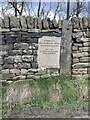
Joan Royd Lane
The name Royd occurs frequently in this area around Penistone.
Image: © Steve Fareham
Taken: 15 Nov 2008
0.10 miles
3
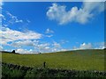
Looks like Summer near Penistone
But 10 minutes earlier it was raining.
Image: © Steve Fareham
Taken: 24 Jun 2012
0.12 miles
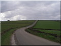
5
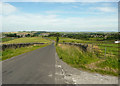
Joan Royd Lane passing through Square SE 24 02
Looking north-westward along the short section of road that passes through Square SE 24 02.
Image: © Peter Wood
Taken: 2 Dec 2015
0.14 miles
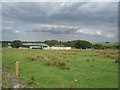
6
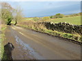
Hartcliff Road towards Penistone, Thurlstone
Image: © Humphrey Bolton
Taken: 30 Jul 2020
0.18 miles
7
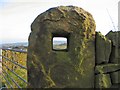
Stone Age TV
A clear view through a post hole in an old stone gatepost, at the point where Cross Lane and Hartcliffe Road intersect.
Image: © Roger May
Taken: 22 Jan 2006
0.19 miles
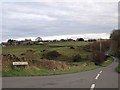
9
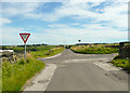
Cross roads on Cross Lane. Thurlstone
Image: © Humphrey Bolton
Taken: 30 Jul 2020
0.19 miles
10
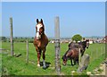
Horses on Hacking Hill with Cubley behind them
Image: © Neil Theasby
Taken: 23 May 2012
0.24 miles