IMAGES TAKEN NEAR TO
Roughbirchworth, Oxspring, SHEFFIELD, S36 8YZ
Introduction
This page details the photographs taken nearby to S36 8YZ by members of the Geograph project.
The Geograph project started in 2005 with the aim of publishing, organising and preserving representative images for every square kilometre of Great Britain, Ireland and the Isle of Man.

There are currently over 7.5m images from over14,400 individuals and you can help contribute to the project by visiting https://www.geograph.org.uk
Image Map
Images are licensed for reuse under creativecommons.org/licenses/by-sa/2.0
Notes
- Clicking on the map will re-center to the selected point.
- The higher the marker number, the further away the image location is from the centre of the postcode.
Image Listing (41 Images Found)
Images are licensed for reuse under creativecommons.org/licenses/by-sa/2.0
Image
Details
Distance
1
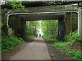
Bridges over the Trans-Pennine Trail at Oxspring
The concrete bridge is a footbridge over the former railway line. Behind it is the road bridge that carries Roughbirchworth Lane from Oxspring to Roughbirchworth. Most of the stone bridges along this route were changed in the late 1940's to lift the height to allow electrification of the line. Hence the change of stone work and the concrete beams under the bed of the bridge.
Image: © Matthew Hatton
Taken: 23 Apr 2011
0.01 miles
2
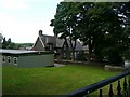
Oxspring School from Roughbirchwood Road
Image: © Wendy North
Taken: 19 Aug 2008
0.01 miles
3
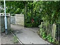
Emerging from the Trans Pennine Trail onto Roughbirchworth Lane in Oxspring
At this point we have virtually completed our circular walk to the west of Oxspring and are looking forward to a meal at the waggon and Horses. Image
Image: © Wendy North
Taken: 19 Aug 2008
0.01 miles
4
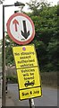
Preparing for Le Tour
A street sign in Oxspring, about three miles from the route of Le Tour.
Image: © Dave Pickersgill
Taken: 26 Jun 2014
0.02 miles
5
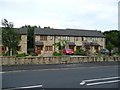
21st Century Cottages on Sheffield Road
Image: © Wendy North
Taken: 16 Aug 2008
0.05 miles
6
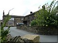
Toll Bar Farm
At one stge this building housed the village cobbler and a butcher as well as the farm. (Oxspring Heritage Group)
Image: © Wendy North
Taken: 16 Aug 2008
0.05 miles
7
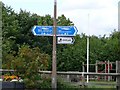
Signs for the Trans Pennine Trail with children's playground behind
Image: © Wendy North
Taken: 16 Aug 2008
0.05 miles
9
Abandoned stone water trough
This former spring fed stone trough was one of many in the village that was used for drinking water. The water was piped from a spring beyond the railway cutting. Unfortunately when the railway was electrified this pipeline was broken. (Oxspring Heritage Group)
Image: © Wendy North
Taken: 16 Aug 2008
0.06 miles