IMAGES TAKEN NEAR TO
Rosemead, SHEFFIELD, S36 7GQ
Introduction
This page details the photographs taken nearby to Rosemead, S36 7GQ by members of the Geograph project.
The Geograph project started in 2005 with the aim of publishing, organising and preserving representative images for every square kilometre of Great Britain, Ireland and the Isle of Man.

There are currently over 7.5m images from over14,400 individuals and you can help contribute to the project by visiting https://www.geograph.org.uk
Image Map
Images are licensed for reuse under creativecommons.org/licenses/by-sa/2.0
Notes
- Clicking on the map will re-center to the selected point.
- The higher the marker number, the further away the image location is from the centre of the postcode.
Image Listing (21 Images Found)
Images are licensed for reuse under creativecommons.org/licenses/by-sa/2.0
Image
Details
Distance
1
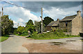
Houses on Huddersfield Road (A629), Ingbirchworth
Image: © JThomas
Taken: 3 Oct 2014
0.01 miles
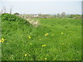
2
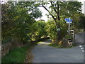
The Trans Pennine Trail (High Lane)
Off Huddersfield Road .
Image: © JThomas
Taken: 3 Oct 2014
0.02 miles
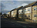
3
High Lane and a sewer pipebridge, Ingbirchworth
Image: © Humphrey Bolton
Taken: 13 Jun 2020
0.05 miles
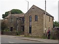
4
The Rose and Crown, Ingbirchworth
Taken from the meadows of Broadfield Farm. This photograph will soon be historical, as the pub will be demolished and the small plot of land developed for housing. Unfortunately the pub had to close down in 2005 after a car crashed into it and affected its structure.
Image: © Barry Hurst
Taken: 9 May 2006
0.07 miles
5
Cottage on Denby Lane
Extended in 2007 according to a datestone above the small window
Image: © Graham Hogg
Taken: 9 Jun 2020
0.07 miles
7
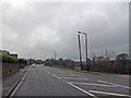
The A629 passes through Ingbirchworth
Image: © Steve Fareham
Taken: 17 Nov 2014
0.11 miles
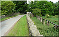
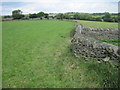
8
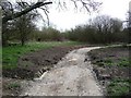
Perimeter path, Scout Dike reservioir
Someone has cleared the drains, rebuilt the culverts and resurfaced the path quite recently.
Image: © Christine Johnstone
Taken: 2 Apr 2011
0.12 miles
9
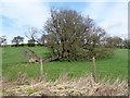
Fallen tree, near Cockle Edge
In a field alongside the Scout Dike reservoir perimeter path. How shallow the roots were, compared with the height of the tree.
Image: © Christine Johnstone
Taken: 2 Apr 2011
0.12 miles