
IMAGES TAKEN NEAR TO
Dalby Croft, SHEFFIELD, S36 6ED
Introduction
This page details the photographs taken nearby to Dalby Croft, S36 6ED by members of the Geograph project.
The Geograph project started in 2005 with the aim of publishing, organising and preserving representative images for every square kilometre of Great Britain, Ireland and the Isle of Man.

There are currently over 7.5m images from over14,400 individuals and you can help contribute to the project by visiting https://www.geograph.org.uk
Image Map
Images are licensed for reuse under creativecommons.org/licenses/by-sa/2.0
Notes
- Clicking on the map will re-center to the selected point.
- The higher the marker number, the further away the image location is from the centre of the postcode.
Image Listing (48 Images Found)
Images are licensed for reuse under creativecommons.org/licenses/by-sa/2.0
Image
Details
Distance
1

WW2 'tank ramp'
This ramp was used during the second world war to load tanks onto the back of lorries. The tanks had been delivered by train to Penistone Railway Station and were destined for the nearby training grounds at Langsett.
Image: © Dave Pickersgill
Taken: 2 Oct 2025
0.06 miles
2

World War Two 'tank ramp'
This ramp was used during the second world war to load tanks onto the back of lorries. The tanks had been delivered by train to Penistone Railway Station and were destined for the nearby training grounds at Langsett.
Image: © Dave Pickersgill
Taken: 2 Oct 2025
0.08 miles
3
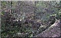
Turntable pit at the former Barnsley Junction Sidings
Nature is steadily reclaiming this blue brick turntable pit. the turntable was in use at what used to be Barnsley Junction Sidings which served the adjacent Penistone Steelworks. Very little evidence remains of these extensive sidings, now, which ran on to the Sheffield to Manchester Woodhead railway, although a little poking around in the shrubbery does turn up a few gems like this one.
Image: © Bobby Clegg
Taken: 12 Oct 2014
0.08 miles
5
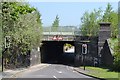
Green Road, Penistone - Bridge under the railway
Image: © Neil Theasby
Taken: 23 May 2012
0.11 miles
6
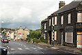
Sheffield Road
Penistone street scene
Image: © Richard Croft
Taken: 11 Sep 2010
0.12 miles
7
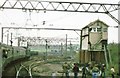
Huddersfield Junction, Penistone
Taken from the official farewell tour train, run just prior to closure of the Woodhead route in 1981. The Health & Safety crowd were not a factor in 1981, even on electrified railway lines. Almost all the infrastructure in the photograph is now just a memory.
Image: © Peter Whatley
Taken: Unknown
0.13 miles
8
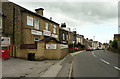
Former Queen Hotel, now a nursery school, Sheffield Road, Penistone
I thought the building looked like a former pub. and sure enough it is named on old maps.
Image: © Humphrey Bolton
Taken: 3 Sep 2020
0.14 miles
9

Up empties passing Penistone Station on the electrified Manchester - Sheffield/Wath main line
View NW, towards Woodhead Tunnel and Manchester, just five days before the New Tunnel was formally opened and full electric operation began. However, electrically hauled freight trains had been running Wath Yard - Dunford Bridge since February 1952 with handover to steam at Dunford Bridge; this train was probably one of those, headed by Bo-Bo EM1 Nos. 26043 + 26042.
Image: © Ben Brooksbank
Taken: 9 Jun 1954
0.14 miles
10
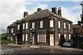
Hinchliff Butcher
Traditional butcher's shop and premises on Sheffield Road http://www.geograph.org.uk/photo/2073877 now closed and boarded up
Image: © Richard Croft
Taken: 11 Sep 2010
0.15 miles