IMAGES TAKEN NEAR TO
New Hall Crescent, SHEFFIELD, S36 1LF
Introduction
This page details the photographs taken nearby to New Hall Crescent, S36 1LF by members of the Geograph project.
The Geograph project started in 2005 with the aim of publishing, organising and preserving representative images for every square kilometre of Great Britain, Ireland and the Isle of Man.

There are currently over 7.5m images from over14,400 individuals and you can help contribute to the project by visiting https://www.geograph.org.uk
Image Map
Images are licensed for reuse under creativecommons.org/licenses/by-sa/2.0
Notes
- Clicking on the map will re-center to the selected point.
- The higher the marker number, the further away the image location is from the centre of the postcode.
Image Listing (45 Images Found)
Images are licensed for reuse under creativecommons.org/licenses/by-sa/2.0
Image
Details
Distance
1
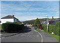
Cross Lane on Smithy Moor, Stocksbridge
Image: © Neil Theasby
Taken: 6 Oct 2013
0.07 miles
2
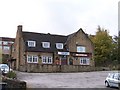
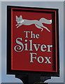
The Silver Fox, Stocksbridge
This pub is built on the land formerly occupied by Half Hall ... that's it, I know no more!
Image: © Terry Robinson
Taken: 7 Nov 2008
0.12 miles
3
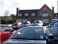
The Silver Fox, Stocksbridge
On Manchester Road.
Image: © JThomas
Taken: 21 Mar 2019
0.12 miles
4
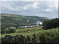
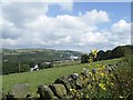
View to the Steelworks from Oaks Lane, near Stocksbridge - 1
The houses in the foreground are on Cross Lane.
Hunshelf Bank towers above the Steelworks
See also ...
Image
Image: © Terry Robinson
Taken: 20 Aug 2012
0.13 miles
6
A collection of photos taken near midday by photographers all over the country.
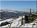
Stocksbridge in the snow - taken from Green Moor.
Image: © Dave Pickersgill
Taken: 25 Dec 2009
0.17 miles
8
View to the Steelworks from Oaks Lane, near Stocksbridge - 2
See also ...
Image
Image: © Terry Robinson
Taken: 20 Aug 2012
0.18 miles
9
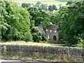
Unsliven Bridge Farm
The farm sits at the very bottom of Underbank reservoir dam. What an interesting name. Can anyone show any light on this?
Terry Robinson has just got in touch and writes: "I'm pretty sure that this is Bridge Farm and not Bank Farm ... it is certainly described thus on the 1903 OS map. As for the meaning of the word Unsliven ... I have used the following explanation on a picture of Unsliven Bridge, which I have just submitted to Geograph ... you can use it on your picture if you wish ... "According to an entry in the second edition of the ‘Around Stocksbridge’ book compiled by Stocksbridge and District Historical Society ... Unsliven is a misspelling of the word Unsleven, which itself is said to have derived from the word Unshriven which means Unblessed." Many thanks Terry.
Image: © Wendy North
Taken: 13 Aug 2008
0.20 miles
10
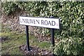
Unsliven Road, Underbank, Stocksbridge
Possibly a unique road name in the UK ... please contact me if you know differently! Follow this link for an explanation of the word 'Unsliven' ... Image
Image: © Terry Robinson
Taken: 8 Mar 2010
0.20 miles