Unsliven Bridge Farm
Introduction
The photograph on this page of Unsliven Bridge Farm by Wendy North as part of the Geograph project.
The Geograph project started in 2005 with the aim of publishing, organising and preserving representative images for every square kilometre of Great Britain, Ireland and the Isle of Man.

There are currently over 7.5m images from over 14,400 individuals and you can help contribute to the project by visiting https://www.geograph.org.uk
Unsliven Bridge Farm
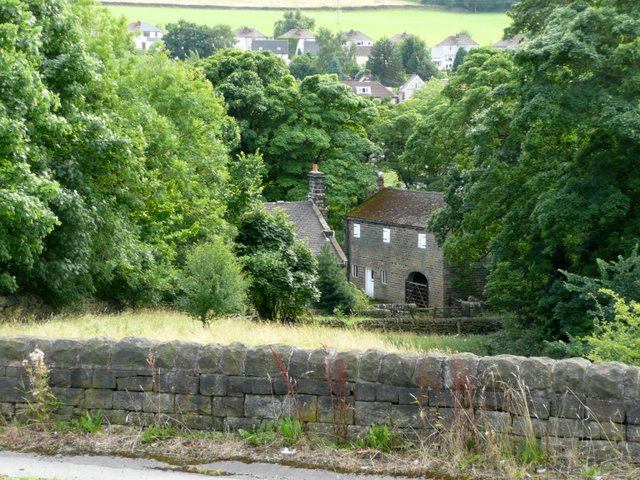
Image: © Wendy North Taken: 13 Aug 2008
The farm sits at the very bottom of Underbank reservoir dam. What an interesting name. Can anyone show any light on this? Terry Robinson has just got in touch and writes: "I'm pretty sure that this is Bridge Farm and not Bank Farm ... it is certainly described thus on the 1903 OS map. As for the meaning of the word Unsliven ... I have used the following explanation on a picture of Unsliven Bridge, which I have just submitted to Geograph ... you can use it on your picture if you wish ... "According to an entry in the second edition of the ‘Around Stocksbridge’ book compiled by Stocksbridge and District Historical Society ... Unsliven is a misspelling of the word Unsleven, which itself is said to have derived from the word Unshriven which means Unblessed." Many thanks Terry.
Images are licensed for reuse under creativecommons.org/licenses/by-sa/2.0
Image Location
Latitude
53.488005
Longitude
-1.618668