
IMAGES TAKEN NEAR TO
The Avenue, SHEFFIELD, S35 7FG
Introduction
This page details the photographs taken nearby to The Avenue, S35 7FG by members of the Geograph project.
The Geograph project started in 2005 with the aim of publishing, organising and preserving representative images for every square kilometre of Great Britain, Ireland and the Isle of Man.

There are currently over 7.5m images from over14,400 individuals and you can help contribute to the project by visiting https://www.geograph.org.uk
Image Map
Images are licensed for reuse under creativecommons.org/licenses/by-sa/2.0
Notes
- Clicking on the map will re-center to the selected point.
- The higher the marker number, the further away the image location is from the centre of the postcode.
Image Listing (34 Images Found)
Images are licensed for reuse under creativecommons.org/licenses/by-sa/2.0
Image
Details
Distance
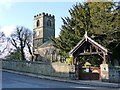
2
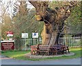
Time for a rest
Seats around the tree at the Entrance to Wortley Hall.
Image: © Steve Fareham
Taken: 6 May 2008
0.09 miles
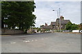
4
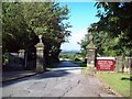
Wortley Hall Entrance Gate
Entrance to the grounds of Wortley Hall, viewed here from the village centre. The hall is the ancestral home of the Wharncliffe family although in more recent times it has enjoyed a rather different function as a meeting hub for various trade union groups.
Image: © Jonathan Clitheroe
Taken: 21 Jul 2010
0.10 miles
5
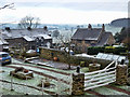
Estate Houses, Wortley Village
The majority of housing in the village belongs to Wortley Estates. Taken from the corner of the churchyard. The Don Valley lies to the west of the village.
Image: © Wendy North
Taken: 15 Jan 2012
0.11 miles
6
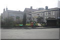
Wortley Stores, Guest House and Post Office
Image: © tony sanger
Taken: 8 Apr 2009
0.11 miles
7
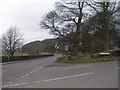
Junction A629/Hermit Hill Lane
The benchmark at Image is on the right hand gatepost
Image: © John Slater
Taken: 29 Feb 2012
0.11 miles
8
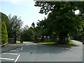
Entrance to Wortley Hall and the Wortley Estate Drive
The start of our walk. Our plan is to walk through the Wortley Hall estate - heading for Tankersley approximately 3 miles to the east. On Google maps the estate drive is called `The Flats'.
Image: © Wendy North
Taken: 26 Jul 2008
0.11 miles
9
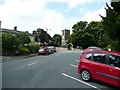
Wortley Church and village car-parking
We park in Wortley village at the start of our walk. St Leonard's church can be seen in the centre of the image. Wortley Post office is to the left.
Image: © Wendy North
Taken: 26 Jul 2008
0.11 miles
10
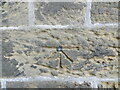
Ordnance Survey Cut Mark with Bolt
This mark and bolt can be found on the wall of St Leonard's Church, Wortley.
The recorded details give a height of 228.1459 metres above sea level.
For more detail see : https://www.bench-marks.org.uk/bm28156
Image: © Peter Wood
Taken: 4 Jun 2022
0.11 miles