IMAGES TAKEN NEAR TO
The Croft, SHEFFIELD, S35 7ES
Introduction
This page details the photographs taken nearby to The Croft, S35 7ES by members of the Geograph project.
The Geograph project started in 2005 with the aim of publishing, organising and preserving representative images for every square kilometre of Great Britain, Ireland and the Isle of Man.

There are currently over 7.5m images from over14,400 individuals and you can help contribute to the project by visiting https://www.geograph.org.uk
Image Map
Images are licensed for reuse under creativecommons.org/licenses/by-sa/2.0
Notes
- Clicking on the map will re-center to the selected point.
- The higher the marker number, the further away the image location is from the centre of the postcode.
Image Listing (10 Images Found)
Images are licensed for reuse under creativecommons.org/licenses/by-sa/2.0
Image
Details
Distance
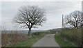
1
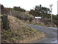
Junction of Eastfield Lane with Pinfold Lane
Both names, 'Eastfield' and 'Pinfold' link this place to medieval farming practice in the area.
Image: © Wendy North
Taken: 9 Mar 2006
0.13 miles
2
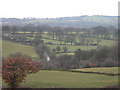
Hilltop Plantation with Berry Moor Cottages
This view looks over Hilltop plantation towards Berry Moor (SE2903) and on towards Silkstone Common. This area of rolling fields is mainly grazed by sheep.
Image: © Wendy North
Taken: 9 Mar 2006
0.13 miles
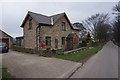
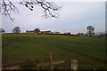
4
Lower Eastfield Farm
Viewed from the road to the west.
Image: © Peter Wood
Taken: 4 Dec 2013
0.15 miles
5
Lower Eastfield Farm
View over farmland.
Image: © Wendy North
Taken: 31 Dec 2003
0.17 miles
8
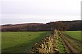
Dry stone wall field boundary
Lower Lee Wood is in the background. Taken when we were walking towards Eastfield.
Image: © Wendy North
Taken: 31 Dec 2003
0.22 miles
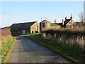
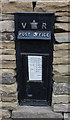
9
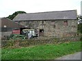
Traditional Stone Barn at Eastfield Farm
Image: © Wendy North
Taken: 27 Jul 2008
0.24 miles
10
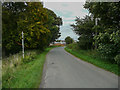
Eastfiled Lane, Thurgoland
The post on the left looks to have been for a road sign, perhaps for the bend ahead.
Image: © Humphrey Bolton
Taken: 10 Sep 2020
0.25 miles