IMAGES TAKEN NEAR TO
Bank Lane, SHEFFIELD, S35 7DG
Introduction
This page details the photographs taken nearby to Bank Lane, S35 7DG by members of the Geograph project.
The Geograph project started in 2005 with the aim of publishing, organising and preserving representative images for every square kilometre of Great Britain, Ireland and the Isle of Man.

There are currently over 7.5m images from over14,400 individuals and you can help contribute to the project by visiting https://www.geograph.org.uk
Image Map
Images are licensed for reuse under creativecommons.org/licenses/by-sa/2.0
Notes
- Clicking on the map will re-center to the selected point.
- The higher the marker number, the further away the image location is from the centre of the postcode.
Image Listing (11 Images Found)
Images are licensed for reuse under creativecommons.org/licenses/by-sa/2.0
Image
Details
Distance
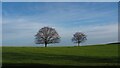
4
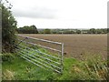
View towards High Green from Bank Lane
Across newly tilled arable land.
Image: © Neil Theasby
Taken: 20 Sep 2013
0.18 miles

7
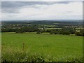
Extensive view over the Dearne Valley from Woodhead Road
Views to the Don and Dearne Valley from this high ground. In the distance are numerous power station cooling towers.
Image: © Steve Fareham
Taken: 26 Jul 2009
0.20 miles
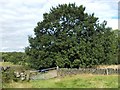
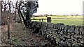
9
Wortley Bank
Looking east across the fields by Bank Lane, to Wortley Bank Farm.
Image: © Roger May
Taken: 13 Mar 2006
0.21 miles
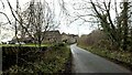
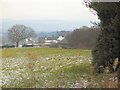
10

Junction of Berry Lane and Sheffield Road (A629)
Image: © Steve Fareham
Taken: 19 Aug 2010
0.23 miles