
IMAGES TAKEN NEAR TO
Roslyn Crescent, HOPE VALLEY, S32 1BX
Introduction
This page details the photographs taken nearby to Roslyn Crescent, S32 1BX by members of the Geograph project.
The Geograph project started in 2005 with the aim of publishing, organising and preserving representative images for every square kilometre of Great Britain, Ireland and the Isle of Man.

There are currently over 7.5m images from over14,400 individuals and you can help contribute to the project by visiting https://www.geograph.org.uk
Image Map
Images are licensed for reuse under creativecommons.org/licenses/by-sa/2.0
Notes
- Clicking on the map will re-center to the selected point.
- The higher the marker number, the further away the image location is from the centre of the postcode.
Image Listing (199 Images Found)
Images are licensed for reuse under creativecommons.org/licenses/by-sa/2.0
Image
Details
Distance
1
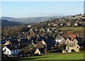
General view of Hathersage
Looking along the Hope Valley to Win Hill
Image: © Neil Theasby
Taken: 29 Dec 2013
0.03 miles
2
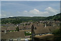
Rooftop level view of Hathersage, from the railway
Image: © David Long
Taken: 25 Jun 2009
0.04 miles
3
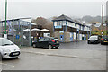
Hathersage Swimming Pool
Being an open air pool, on this cold autumn day you can see steam from the pool blowing over the roof to the right of the photograph.
Image: © Mark Anderson
Taken: 27 Oct 2020
0.04 miles
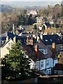
5
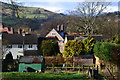
View over Hathersage with snow on Mam Tor
Image: © David Martin
Taken: 21 Feb 2015
0.07 miles
7
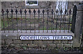
Oddfellows Road
The Oddfellows Hall must have been a major landmark in Victorian Hathersage - it gets frequently mentioned in road names.
The Oddfellows - or "The Independent Order of Oddfellows Manchester Unity Friendly Society Limited" is basically a "friendly" society, a social club with charitable purpose and social engagement. It still exists, although at one time there were lodges and halls all over the country. Its membership overlapped somewhat with the temperance movement.
Image: © Bob Harvey
Taken: 15 Feb 2023
0.07 miles
8
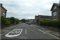
Oddfellows Road
Looking along Oddfellows Road from the junction with Station Road in Hathersage.
Image: © DS Pugh
Taken: 26 Aug 2022
0.07 miles
9
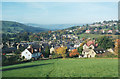
Path into Hathersage
According to even large scale maps this path goes round the edge of the field, but in practice it cuts diagonally across (aerial photography confirms I have the right field!)
Image: © Stephen Craven
Taken: 18 Oct 1998
0.07 miles
10
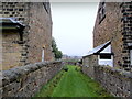
Gap between Dwellings, Hathersage
A green way leads between dwellings on Crossland Road in Hathersage, Derbyshire
Image: © Chris Heaton
Taken: 20 Sep 2011
0.07 miles