IMAGES TAKEN NEAR TO
Doleswood Drive, SHEFFIELD, S25 1ZB
Introduction
This page details the photographs taken nearby to Doleswood Drive, S25 1ZB by members of the Geograph project.
The Geograph project started in 2005 with the aim of publishing, organising and preserving representative images for every square kilometre of Great Britain, Ireland and the Isle of Man.

There are currently over 7.5m images from over14,400 individuals and you can help contribute to the project by visiting https://www.geograph.org.uk
Image Map
Images are licensed for reuse under creativecommons.org/licenses/by-sa/2.0
Notes
- Clicking on the map will re-center to the selected point.
- The higher the marker number, the further away the image location is from the centre of the postcode.
Image Listing (26 Images Found)
Images are licensed for reuse under creativecommons.org/licenses/by-sa/2.0
Image
Details
Distance
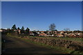
1
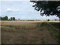
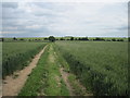
Crop Field Adjoining Kirk Croft Road
Wheat field and bridleway near Laughton en le Morthen. Houses on the fringes of the village can be seen on the left.
Image: © Jonathan Clitheroe
Taken: 5 Aug 2016
0.09 miles
2
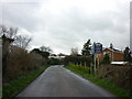
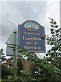
Entering Laughton-en-le-Morthen on East Field Lane
Image: © Ian S
Taken: 9 Mar 2011
0.14 miles
3
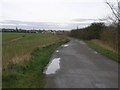
Lane to Laughton
The village of Laughton en le Morthen and its distinctive church spire can be seen on the horizon.
Image: © Michael Patterson
Taken: 7 Apr 2006
0.15 miles
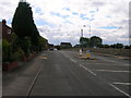
4
Muddy track towards Laughton-en-le-Morthen
Image: © Chris Morgan
Taken: 3 Mar 2014
0.15 miles
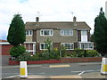
5
Entering the Village
This area was settled before 1066. Earl Edwin had a hall here.
Image: © Martin Dawes
Taken: 27 Jun 2012
0.16 miles
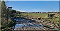
6
Kirk Croft Road ( Track )
Running east to Long Thwaite Wood
Image: © Martin Dawes
Taken: 27 Jun 2012
0.16 miles
10
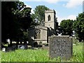
St John's Church, Laughton en le Morthen
Image: © Neil Theasby
Taken: 22 Jul 2014
0.19 miles