IMAGES TAKEN NEAR TO
Clarke Square, SHEFFIELD, S2 4NZ
Introduction
This page details the photographs taken nearby to Clarke Square, S2 4NZ by members of the Geograph project.
The Geograph project started in 2005 with the aim of publishing, organising and preserving representative images for every square kilometre of Great Britain, Ireland and the Isle of Man.

There are currently over 7.5m images from over14,400 individuals and you can help contribute to the project by visiting https://www.geograph.org.uk
Image Map (214 Images)


Getting Data...Please wait
Leaflet Map data © OpenStreetMap
Images are licensed for reuse under creativecommons.org/licenses/by-sa/2.0
Notes
- Clicking on the map will re-center to the selected point.
- The higher the marker number, the further away the image location is from the centre of the postcode.
Image Listing (214 Images Found)
Images are licensed for reuse under creativecommons.org/licenses/by-sa/2.0
Image
Details
Distance
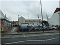
1
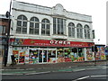
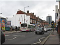
An early April walk along the London Road 36
Image: © Basher Eyre
Taken: 3 Apr 2012
0.02 miles
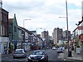
2
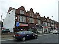
An early April walk along the London Road 40
Image: © Basher Eyre
Taken: 3 Apr 2012
0.02 miles
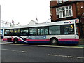
3
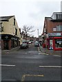
An early April walk along the London Road 33
Looking across to Clarke Square
Image: © Basher Eyre
Taken: 3 Apr 2012
0.02 miles
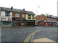
4
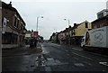
An early April walk along the London Road 37
Taken from Randall Place, looking south-eastwards.
Image: © Basher Eyre
Taken: 3 Apr 2012
0.03 miles
5
An early April walk along the London Road 38
Image: © Basher Eyre
Taken: 3 Apr 2012
0.03 miles
7
An early April walk along the London Road 42
Image: © Basher Eyre
Taken: 3 Apr 2012
0.03 miles
8
An early April walk along the London Road 31
Junction with Alderson Road
Image: © Basher Eyre
Taken: 3 Apr 2012
0.03 miles
10
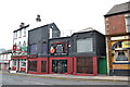
Chinese bar and restaurant, London Road
Between the Crown Inn and the Barrel.
Image: © Peter Barr
Taken: 20 May 2013
0.03 miles