IMAGES TAKEN NEAR TO
Manvers Road, SHEFFIELD, S20 1AX
Introduction
This page details the photographs taken nearby to Manvers Road, S20 1AX by members of the Geograph project.
The Geograph project started in 2005 with the aim of publishing, organising and preserving representative images for every square kilometre of Great Britain, Ireland and the Isle of Man.

There are currently over 7.5m images from over14,400 individuals and you can help contribute to the project by visiting https://www.geograph.org.uk
Image Map
Images are licensed for reuse under creativecommons.org/licenses/by-sa/2.0
Notes
- Clicking on the map will re-center to the selected point.
- The higher the marker number, the further away the image location is from the centre of the postcode.
Image Listing (27 Images Found)
Images are licensed for reuse under creativecommons.org/licenses/by-sa/2.0
Image
Details
Distance
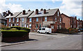
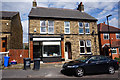
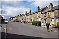

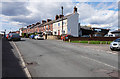
7
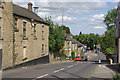
Beighton
Looking down High Street as it falls quite steeply from the area around the church into the bottom of the Rother Valley.
Image: © Stephen McKay
Taken: 27 Aug 2007
0.18 miles
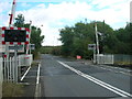
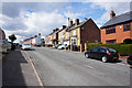
10
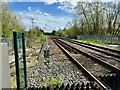
Rail line north east of Beighton
Carries passenger services between Sheffield and Chesterfield.
Image: © David Lally
Taken: 6 Apr 2024
0.18 miles