IMAGES TAKEN NEAR TO
Bowness Close, DRONFIELD, S18 8PE
Introduction
This page details the photographs taken nearby to Bowness Close, S18 8PE by members of the Geograph project.
The Geograph project started in 2005 with the aim of publishing, organising and preserving representative images for every square kilometre of Great Britain, Ireland and the Isle of Man.

There are currently over 7.5m images from over14,400 individuals and you can help contribute to the project by visiting https://www.geograph.org.uk
Image Map
Images are licensed for reuse under creativecommons.org/licenses/by-sa/2.0
Notes
- Clicking on the map will re-center to the selected point.
- The higher the marker number, the further away the image location is from the centre of the postcode.
Image Listing (7 Images Found)
Images are licensed for reuse under creativecommons.org/licenses/by-sa/2.0
Image
Details
Distance
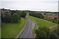
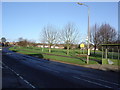
2
Gosforth Valley Flyover
Now become an iconic symbol for this part of the town.
Image: © Ted Thomas
Taken: 14 Jan 2007
0.22 miles
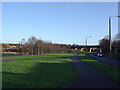
3
Footpath along southern boundary of Gosforth Estate
The first sunshine the walkers had seen all day.
Image: © Chris Morgan
Taken: 18 Nov 2013
0.23 miles
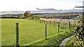
4

Footpath at the edge of Dronfield
The footpath is squeezed between the fence and the bushes
Image: © Graham Hogg
Taken: 18 Nov 2013
0.23 miles
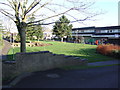
5
Sindlefingen Park, Gosforth Valley
A green space within the Gosforth Valley housing estate dedicated to Dronfield's twin town of Sindlefingen, Germany. The Gosforth Valley Estate was, in the early 1970's when it was built, the largest private housing estate in western europe.
Image: © Ted Thomas
Taken: 14 Jan 2007
0.24 miles
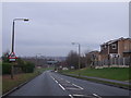
6
St Andrews Church and Pentland Road Shops, Gosforth Valley
A Church strong in the ecumenical tradition with its church school nearby.
Image: © Ted Thomas
Taken: 14 Jan 2007
0.24 miles