
IMAGES TAKEN NEAR TO
Ullswater Close, DRONFIELD, S18 8NW
Introduction
This page details the photographs taken nearby to Ullswater Close, S18 8NW by members of the Geograph project.
The Geograph project started in 2005 with the aim of publishing, organising and preserving representative images for every square kilometre of Great Britain, Ireland and the Isle of Man.

There are currently over 7.5m images from over14,400 individuals and you can help contribute to the project by visiting https://www.geograph.org.uk
Image Map
Images are licensed for reuse under creativecommons.org/licenses/by-sa/2.0
Notes
- Clicking on the map will re-center to the selected point.
- The higher the marker number, the further away the image location is from the centre of the postcode.
Image Listing (13 Images Found)
Images are licensed for reuse under creativecommons.org/licenses/by-sa/2.0
Image
Details
Distance
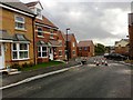
2
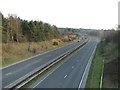
Gosforth Valley.
The A61 Unstone - Dronfield bypass.
Image: © Mike Fowkes
Taken: 23 Mar 2006
0.16 miles
3
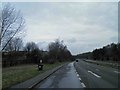
Lay-by on the A61 Dronfield by pass #2
Image: © Steve Fareham
Taken: 12 Mar 2011
0.18 miles
4
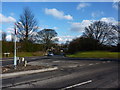
Stubley Hollow leaves Stubley Lane
Road junction in Dronfield Woodhouse
Image: © Peter Barr
Taken: 20 Feb 2010
0.19 miles
5
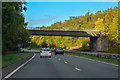
Dronfield : The A61 Unstone-Dronfield By-Pass
A road heading into and through Dronfield.
Image: © Lewis Clarke
Taken: 30 Sep 2018
0.20 miles
7
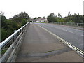
Stubley Lane - Crossing over the (A61) Dronfield Bypass
Image: © Alan Heardman
Taken: 25 Aug 2009
0.20 miles
8
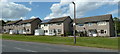
Houses on Stubley Lane
The first houses on the north side of the road west of the A61 bridge.
Image: © Andrew Hill
Taken: 24 May 2011
0.21 miles
10

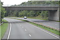
Gosforth Valley Flyover
Now become an iconic symbol for this part of the town.
Image: © Ted Thomas
Taken: 14 Jan 2007
0.24 miles