IMAGES TAKEN NEAR TO
Dyche Lane, DRONFIELD, S18 3AB
Introduction
This page details the photographs taken nearby to Dyche Lane, S18 3AB by members of the Geograph project.
The Geograph project started in 2005 with the aim of publishing, organising and preserving representative images for every square kilometre of Great Britain, Ireland and the Isle of Man.

There are currently over 7.5m images from over14,400 individuals and you can help contribute to the project by visiting https://www.geograph.org.uk
Image Map
Images are licensed for reuse under creativecommons.org/licenses/by-sa/2.0
Notes
- Clicking on the map will re-center to the selected point.
- The higher the marker number, the further away the image location is from the centre of the postcode.
Image Listing (21 Images Found)
Images are licensed for reuse under creativecommons.org/licenses/by-sa/2.0
Image
Details
Distance
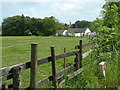
1
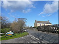
Coal Aston - Dyche Lane View from Ferndale Garden Centre
Image: © Alan Heardman
Taken: 26 Feb 2008
0.01 miles
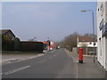
2
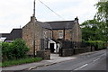
Dyche Lane, Dronfield, Derbyshire
Large house on the outskirts of Coal Aston.
Image: © Graham Hogg
Taken: 11 Jun 2010
0.01 miles
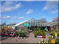
3
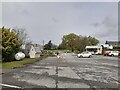
Garden Centre
Car park at the local Garden Centre.
Image: © Peter Mackenzie
Taken: 4 May 2021
0.02 miles
4
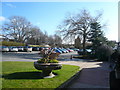
Coal Aston - View from Ferndale Garden Centre Car Park
Image: © Alan Heardman
Taken: 26 Feb 2008
0.02 miles
5
Field by Dyche lane
Towards Coal Aston and Dronfield.
Image: © Andrew Hill
Taken: 24 May 2011
0.03 miles
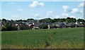
7
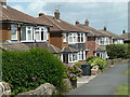
Houses on Wilson Road
These houses back onto the short stretch of open country between Coal Aston near Dronfield and the southern outskirts of Sheffield.
Image: © Andrew Hill
Taken: 24 May 2011
0.07 miles
8
Houses, Coal Aston, Derbyshire
The rear of Meadow Close and Wilson Road
Image: © Graham Hogg
Taken: 11 Jun 2010
0.09 miles
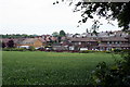
10
Footpath to houses in Coal Aston
Looking across a field to houses in Coal Aston which also marks the edge of the Dronfield built up area.
Image: © Andrew Hill
Taken: 14 Jun 2011
0.13 miles