IMAGES TAKEN NEAR TO
Snape Hill Crescent, DRONFIELD, S18 2DR

Introduction

This page details the photographs taken nearby to Snape Hill Crescent, S18 2DR by members of the Geograph project.

The Geograph project started in 2005 with the aim of publishing, organising and preserving representative images for every square kilometre of Great Britain, Ireland and the Isle of Man.

There are currently over 7.5m images from over14,400 individuals and you can help contribute to the project by visiting https://www.geograph.org.uk

Image Map


Images are licensed for reuse under creativecommons.org/licenses/by-sa/2.0
Notes
  • Clicking on the map will re-center to the selected point.
  • The higher the marker number, the further away the image location is from the centre of the postcode.

Image Listing (19 Images Found)

Images are licensed for reuse under creativecommons.org/licenses/by-sa/2.0
Image
Details
Distance
1
New Industrial unit, Dronfield
Image: © N Chadwick Taken: 29 Oct 2014
0.10 miles
2
Aldi supermarket
Image: © Peter Mackenzie Taken: 13 Oct 2020
0.10 miles
3
Steps leading up to wooded area from Sheffield Road (B6057)
There used to be houses here. There is an Ordnance Survey benchmark Image at the junction of walls to the right of the BT pole where the party wall between Nos. 113 and 112 once met the roadside wall.
Image: © Roger Templeman Taken: 6 May 2019
0.13 miles
4
House on Snape Hill
Image: © N Chadwick Taken: 29 Oct 2014
0.14 miles
5
Benchmark on wall on east side Sheffield Road
Ordnance Survey cut mark benchmark levelled at 144.777m above Newlyn Datum and verified in 1961
Image: © Roger Templeman Taken: 6 May 2019
0.14 miles
6
Dronfield - Cecil Avenue
Looking towards Snape Hill Lane.
Image: © Alan Heardman Taken: 18 Oct 2007
0.15 miles
7
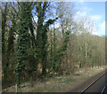
Woodland beside the Derby to Sheffield railway
Image: © JThomas Taken: 18 Apr 2013
0.16 miles
8
Cecil Road, Dronfield
Image: © Neil Theasby Taken: 6 Mar 2012
0.17 miles
9
Sainsbury's, Dronfield
Image: © Alex McGregor Taken: 4 Sep 2013
0.18 miles
10
Princess Road, Dronfield
Image: © Neil Theasby Taken: 6 Mar 2012
0.19 miles