IMAGES TAKEN NEAR TO
Fairwinds Close, DRONFIELD, S18 1RZ
Introduction
This page details the photographs taken nearby to Fairwinds Close, S18 1RZ by members of the Geograph project.
The Geograph project started in 2005 with the aim of publishing, organising and preserving representative images for every square kilometre of Great Britain, Ireland and the Isle of Man.

There are currently over 7.5m images from over14,400 individuals and you can help contribute to the project by visiting https://www.geograph.org.uk
Image Map
Images are licensed for reuse under creativecommons.org/licenses/by-sa/2.0
Notes
- Clicking on the map will re-center to the selected point.
- The higher the marker number, the further away the image location is from the centre of the postcode.
Image Listing (54 Images Found)
Images are licensed for reuse under creativecommons.org/licenses/by-sa/2.0
Image
Details
Distance
1
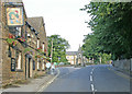
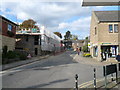
A view in old Dronfield village showing the Blue Stoops public house and the Peel Monument in the distance.
The Corn Law monument was erected in 1846 to celebrate the repeal of the corn laws .
Image: © Tony Godwin
Taken: 12 Jul 2003
0.06 miles
2
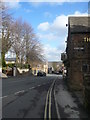
Dronfield High Street
View of The Blue Stoops and Stoops Yard.
Image: © Alan Heardman
Taken: 26 Feb 2008
0.07 miles
3
Dronfield - Civic Centre (Re-development Work)
Image: © Alan Heardman
Taken: 18 Oct 2007
0.08 miles
4
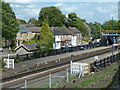
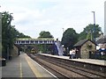
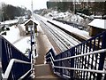
Looking across Dronfield station
The northwestern end of the platforms seen from Lea Road.
Image: © Andrew Hill
Taken: 24 May 2011
0.08 miles
5
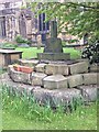
Old Central Cross - moved to St John's churchyard, Dronfield parish
Dronfield Churchyard Cross, old base, steps and stump of shaft, by the churchyard path, in parish of Dronfield (North East Derbyshire District), St John's Churchyard, above steps on South side of churchyard.
Grade II listed.
List Entry Number: 1087762 https://historicengland.org.uk/listing/the-list/list-entry/1087762
Surveyed
Milestone Society National ID: DENE_DRO
Image: © Alan Rosevear
Taken: 30 May 2013
0.09 miles
6
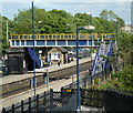
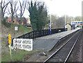
Dronfield station and footbridge
Seen from the walkway from Lea Road.
Image: © Andrew Hill
Taken: 24 May 2011
0.09 miles
8
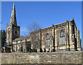
Dronfield - Parish Church
Dedicated to St John the Baptist.
Image: © Dave Bevis
Taken: 7 Mar 2011
0.09 miles