IMAGES TAKEN NEAR TO
Castlerow Close, SHEFFIELD, S17 4RA
Introduction
This page details the photographs taken nearby to Castlerow Close, S17 4RA by members of the Geograph project.
The Geograph project started in 2005 with the aim of publishing, organising and preserving representative images for every square kilometre of Great Britain, Ireland and the Isle of Man.

There are currently over 7.5m images from over14,400 individuals and you can help contribute to the project by visiting https://www.geograph.org.uk
Image Map
Images are licensed for reuse under creativecommons.org/licenses/by-sa/2.0
Notes
- Clicking on the map will re-center to the selected point.
- The higher the marker number, the further away the image location is from the centre of the postcode.
Image Listing (51 Images Found)
Images are licensed for reuse under creativecommons.org/licenses/by-sa/2.0
Image
Details
Distance
1
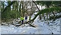
Volunteers clearing fallen trees
After a foot of wet, heavy snow had fallen the previous day - and had mostly all melted by the day following.
Image: © Chris Morgan
Taken: 12 Mar 2023
0.05 miles
2
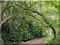
Death of a tree
Supported by its neighbours this tree had slipped too far. It was felled later in the day.
Image: © Chris Morgan
Taken: 22 Jul 2019
0.06 miles
3
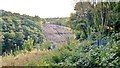
Clearing excess growth by Bradway Tunnel
Twentywell Lane at opposite side of cutting.
Trees have grown profusely on the steep sides of the valley. Network Rail contractors were advancing into the woods with excavators and abseiling equipment to declare war on the vegetation. A finished section is visible in the distance. Needless to say, it's controversial with local residents. Sadly, such healthy vegetation overhanging a mainline railway isn't too healthy for train safety, so it has to go.
Image: © Chris Morgan
Taken: 1 Oct 2012
0.08 miles
7
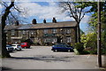
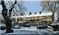
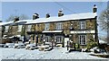
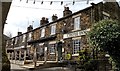
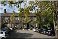
The Castle Inn on Twentywell Road
Bradway Bank, Sheffield.
Image: © Ian S
Taken: 3 May 2014
0.08 miles
9
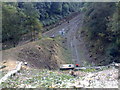
Dore South Junction, Sheffield
Below Poynton Wood and Bradway Bank to the right, and Twentywell Lane to the left. In days gone by there was a signal box about here. This was taken from above a small tunnel covering the tightly curving single track linking to the Hope Valley line towards Manchester. It was previously a double track. Freight trains use this line to and from the Lafarge Cement works at Hope.
The double track is the mainline used by East Midlands Trains between Sheffield and London St Pancras. It is also used by Crosscountry Trains running from as far south as Penzance and Reading up to Edinburgh and Glasgow. Northern Trains pass here between Nottingham and Leeds. East Midlands Trains also operate from Liverpool to Norwich. A trainspotters heaven in days gone by.
At the time this picture was taken contractors were ruthlessly removing almost all vegetation from the hillsides due to fears of trees falling on the line! It revealed much that had been hidden for generations - this was only the start.
Image: © Chris Morgan
Taken: 14 Oct 2008
0.08 miles