
IMAGES TAKEN NEAR TO
The Green, SHEFFIELD, S17 4AT
Introduction
This page details the photographs taken nearby to The Green, S17 4AT by members of the Geograph project.
The Geograph project started in 2005 with the aim of publishing, organising and preserving representative images for every square kilometre of Great Britain, Ireland and the Isle of Man.

There are currently over 7.5m images from over14,400 individuals and you can help contribute to the project by visiting https://www.geograph.org.uk
Image Map
Images are licensed for reuse under creativecommons.org/licenses/by-sa/2.0
Notes
- Clicking on the map will re-center to the selected point.
- The higher the marker number, the further away the image location is from the centre of the postcode.
Image Listing (55 Images Found)
Images are licensed for reuse under creativecommons.org/licenses/by-sa/2.0
Image
Details
Distance
3
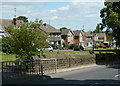
Totley Grange Drive from the main road
Modern houses in Totley set back from the A621 Baslow Road.
Image: © Andrew Hill
Taken: 24 Jul 2011
0.10 miles
4
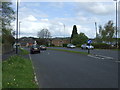
Baslow Road (A621)
Heading east into Sheffield.
Image: © JThomas
Taken: 26 Apr 2014
0.13 miles
5
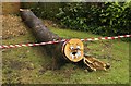
The Totley Walrus has been captured!
A recently felled tree beside the A621 Baslow Road has been stripped of its branches, but much of the trunk remains, decorated with safety tape and a bit of enterprising private art. I wonder how long this will be left to amuse passers by? Update: by 9.30 this morning (4th July) the Walrus had been cut up and was being removed.
Image: © Chris Morgan
Taken: 28 Jun 2014
0.14 miles
8
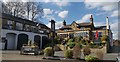
Ye Olde Cross Scythes, Totley
An old coaching inn
Image: © Chris Morgan
Taken: 8 Apr 2020
0.16 miles
9
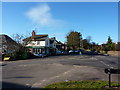
Liberty Foods Farm Shop
Junction of Main Avenue and Baslow Road, Totley, Sheffield
Image: © Peter Barr
Taken: 30 Jan 2010
0.16 miles
10
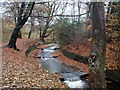
Oldhay Brook
Looking upstream by some of the line of weirs along this stretch of the stream. Around the curve the start of the aqueduct over the railway can be seen.
Image: © Andrew Hill
Taken: 20 Nov 2012
0.16 miles