IMAGES TAKEN NEAR TO
Owler Bar, SHEFFIELD, S17 3BP

Introduction

This page details the photographs taken nearby to Owler Bar, S17 3BP by members of the Geograph project.

The Geograph project started in 2005 with the aim of publishing, organising and preserving representative images for every square kilometre of Great Britain, Ireland and the Isle of Man.

There are currently over 7.5m images from over14,400 individuals and you can help contribute to the project by visiting https://www.geograph.org.uk

Image Map (7 Images)

Marker

Images are licensed for reuse under creativecommons.org/licenses/by-sa/2.0
Notes
  • Clicking on the map will re-center to the selected point.
  • The higher the marker number, the further away the image location is from the centre of the postcode.

Image Listing (7 Images Found)

Images are licensed for reuse under creativecommons.org/licenses/by-sa/2.0
Image
Details
Distance
1
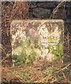
Old Milestone by the B6054, south east of Owler Bar
Carved stone post by the B6054, in parish of HOLMESFIELD (NORTH EAST DERBYSHIRE District), Dronfield Road, half mile East of Owler Bar (Peacock Inn), West of Pewitt Farm, on grass verge in front of stone wall, on South side of road. Calver twin panel, erected by the Owler Bar (Norton to Hathersage) turnpike trust in the 19th century. Inscription reads:- : GLEADLESS / 8 / MILES : : CALVER / 6 / MILES : Grade II Listed. List Entry Number:1109631 https://historicengland.org.uk/listing/the-list/list-entry/1109631 Milestone Society National ID: DE_CAGL06.
Image: © J Higgins Taken: 1 Nov 2002
0.08 miles
2
Old milestone
The Gleadless 8/Calver 6 stone on the south side of the B6054 between the A621 Owler Bar and Pewitt Farm, 20m from Bends sign. In May it was hidden in tall grass at the back of the verge by the stone wall. On the Greenhill Moor to Buxton turnpike first enacted 1781 and extended to Gleadless in 1825.
Image: © Chris Minto Taken: 30 May 2021
0.08 miles
3
B6054 from Holmesfield to Owler Bar
So near, and yet so far on this day when only 4x4s could get up the small rise to the more major A621 less than 400 yards ahead around the curve. A rise that is hardly noticeable in a modern car without snow to contend with. Coming down was clearly less of a problem.
Image: © Chris Morgan Taken: 3 Dec 2010
0.14 miles
4
View across Moorwood Lane
Near Green Acre Farm
Image: © Neil Theasby Taken: 2 Apr 2015
0.18 miles
5
Carl's Wood
A new wood - watch this space! The stone says "Carl's Wood 2007 Jack was here" but also a cryptic phrase that looks like "hon noi theoi philousi apothnoskei ni os". Is that what it says, and what does it mean? It looks like Italian, but why out here?
Image: © Chris Morgan Taken: 18 Mar 2013
0.24 miles
6
Moorwood Lane
View along the lane towards the moors.
Image: © Andrew Hill Taken: 24 Jul 2011
0.24 miles
7
Southerly view from Owler Bar near Sheffield.
Image: © Andrew Loughran Taken: 19 May 2006
0.25 miles