Old Milestone by the B6054, south east of Owler Bar
Introduction
The photograph on this page of Old Milestone by the B6054, south east of Owler Bar by J Higgins as part of the Geograph project.
The Geograph project started in 2005 with the aim of publishing, organising and preserving representative images for every square kilometre of Great Britain, Ireland and the Isle of Man.

There are currently over 7.5m images from over 14,400 individuals and you can help contribute to the project by visiting https://www.geograph.org.uk
Old Milestone by the B6054, south east of Owler Bar
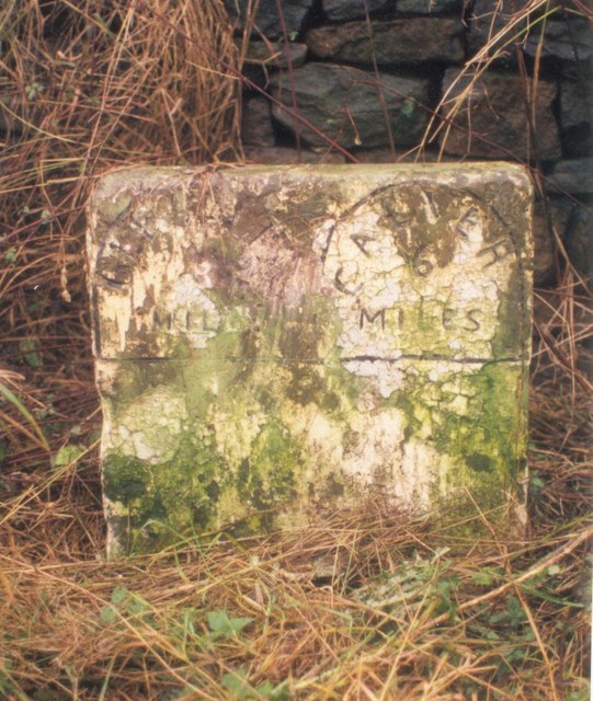
Image: © J Higgins Taken: 1 Nov 2002
Carved stone post by the B6054, in parish of HOLMESFIELD (NORTH EAST DERBYSHIRE District), Dronfield Road, half mile East of Owler Bar (Peacock Inn), West of Pewitt Farm, on grass verge in front of stone wall, on South side of road. Calver twin panel, erected by the Owler Bar (Norton to Hathersage) turnpike trust in the 19th century. Inscription reads:- : GLEADLESS / 8 / MILES : : CALVER / 6 / MILES : Grade II Listed. List Entry Number:1109631 https://historicengland.org.uk/listing/the-list/list-entry/1109631 Milestone Society National ID: DE_CAGL06.
Images are licensed for reuse under creativecommons.org/licenses/by-sa/2.0
Image Location


Leaflet Map data © OpenStreetMap
Latitude
53.297272
Longitude
-1.552896