1
Paradise Square (north side) Sheffield
Image: © Stanley Walker
Taken: 31 Aug 2009
0.02 miles
2
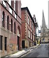
Sheffield: Paradise Square from Silver Street Head
Another view of
Image from the road curiously named Silver Street Head, showing the gradient on which the square stands.
Image: © Chris Downer
Taken: 26 Apr 2008
0.03 miles
3
Sheffield, S1 - Paradise Square
Paradise Street is seen on the right and Silver Street Head on the left. The reasoning behind the use of the name Paradise Square, the central feature, is uncertain although local historians R.E.Leader and S.O.Addy have speculated that it may be an allusion to the ancient use of Paradise or Parvis as the name for a garden or enclosed space near to a church. The first recorded assembly in Paradise Square was on 15 July 1779 when John Wesley preached to what he would later note in his journal as "the largest congregation I ever saw on a weekday".
Image: © David Hallam-Jones
Taken: 27 Oct 2012
0.03 miles
4
St Peter's Close, Sheffield
This tall, gabled brick-fronted building at the corner of North Church Street was a former synagogue dating from 1872.
.
Image: © David Hallam-Jones
Taken: 19 Feb 2018
0.03 miles
5
Sheffield: the Three Tuns
A pub on the extraordinarily thin wedge-shaped corner of Lee Croft and Silver Street Head.
Image: © Chris Downer
Taken: 26 Apr 2008
0.03 miles
6
Down and out on Wheats Lane, Sheffield (I)
A homeless man rests on the steps of a Georgian building. Nearby Sheffield Cathedral is a magnet for the homeless providing a range of services and support.
Image: © Neil Theasby
Taken: 13 Jul 2018
0.03 miles
7
Down and out on Wheats Lane, Sheffield (II)
A homeless man rests on the steps of a Georgian building. Nearby Sheffield Cathedral is a magnet for the homeless - providing a range of services and support.
Image: © Neil Theasby
Taken: 13 Jul 2018
0.03 miles
8
Down and out on Wheats Lane, Sheffield (III)
A homeless man rests on the steps of a Georgian building. Nearby Sheffield Cathedral is a magnet for the homeless providing a range of services and support.
Image: © Neil Theasby
Taken: 13 Jul 2018
0.03 miles
9
Wheats Lane (off North Church Street), Sheffield
A little lane that isn't named on Google Maps. The Building on the left is a Grade 2 Egypto-Greek style listed building, built circa 1830. The lane leads to Paradise Square which has some of the finest Georgian buildings in Sheffield.
Image: © Nick Morris
Taken: 4 Jun 2014
0.03 miles
10
North Church Street, Sheffield
The inscription above the doorway immediately beyond the graffiti-marked wall indicates that this tall gabled brick-fronted building was a former synagogue dating from 1872. The rear of the Anglican cathedral is evident on the opposite side of Campo Lane.
Image: © David Hallam-Jones
Taken: 19 Feb 2018
0.03 miles


