IMAGES TAKEN NEAR TO
Bath Road, ROMFORD, RM6 6NH
Introduction
This page details the photographs taken nearby to Bath Road, RM6 6NH by members of the Geograph project.
The Geograph project started in 2005 with the aim of publishing, organising and preserving representative images for every square kilometre of Great Britain, Ireland and the Isle of Man.

There are currently over 7.5m images from over14,400 individuals and you can help contribute to the project by visiting https://www.geograph.org.uk
Image Map
Images are licensed for reuse under creativecommons.org/licenses/by-sa/2.0
Notes
- Clicking on the map will re-center to the selected point.
- The higher the marker number, the further away the image location is from the centre of the postcode.
Image Listing (63 Images Found)
Images are licensed for reuse under creativecommons.org/licenses/by-sa/2.0
Image
Details
Distance
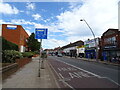
1

Signposts, Chadwell Heath
At the junction of Mill Lane, South Road and East Road. The Chase opposite is a path, but with houses on it.
Image: © Robin Webster
Taken: 2 Apr 2011
0.09 miles
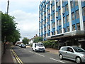
2
Mill Lane, Chadwell Heath
Looking from the corner of Mill Lane and the High Road, Chadwell Heath.
Image: © Trevor Harris
Taken: 27 May 2022
0.10 miles
3

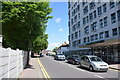
Frankland Moore House
Office block on High Road.
Image: © JThomas
Taken: 22 Aug 2022
0.10 miles
5

Chadwell Heath United Reformed Church
On Mill Lane.
Image: © Robin Webster
Taken: 2 Apr 2011
0.13 miles

8

United Reformed Church, Mill Lane
In a quiet area of Chadwell Heath.
Image: © Robin Webster
Taken: 2 Apr 2011
0.13 miles
9
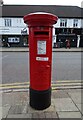
George V postbox on High Road
Postbox No. RM6 126.
Image: © JThomas
Taken: 22 Aug 2022
0.13 miles
10
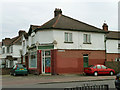
Mill Stores, Mill Lane (closed)
The windows are whitewashed over.
Image: © Robin Webster
Taken: 2 Apr 2011
0.13 miles