IMAGES TAKEN NEAR TO
Ivaro Close, ROMFORD, RM5 3FF
Introduction
This page details the photographs taken nearby to Ivaro Close, RM5 3FF by members of the Geograph project.
The Geograph project started in 2005 with the aim of publishing, organising and preserving representative images for every square kilometre of Great Britain, Ireland and the Isle of Man.

There are currently over 7.5m images from over14,400 individuals and you can help contribute to the project by visiting https://www.geograph.org.uk
Image Map
Images are licensed for reuse under creativecommons.org/licenses/by-sa/2.0
Notes
- Clicking on the map will re-center to the selected point.
- The higher the marker number, the further away the image location is from the centre of the postcode.
Image Listing (6 Images Found)
Images are licensed for reuse under creativecommons.org/licenses/by-sa/2.0
Image
Details
Distance
1

Lawns Park Recreation Ground
A welcome patch of green surrounded by houses.
Image: © Glyn Baker
Taken: 24 Apr 2026
0.03 miles
2

Play Space in Lawns Park
Play equipment for all ages.
Image: © Glyn Baker
Taken: 24 Apr 2026
0.06 miles
3

Lawns Park Summer Meadow
The grassland here is managed for biodiversity. It is cut once a year in Autumn. Another advantage for the Council is it is cheaper that way!
Image: © Glyn Baker
Taken: 24 Apr 2026
0.07 miles
4
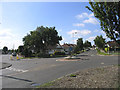
Mini-roundabout, Havering Road, Collier Row, Romford, Essex
Looking south at junction with Pettits Lane North.
Image: © John Winfield
Taken: 8 Aug 2005
0.20 miles
5

Mowbrays Road
A street of 1930's houses typical of the Collier Row area. Note the split windscreen Morris Minor.
Image: © Glyn Baker
Taken: 24 Apr 2026
0.21 miles