
IMAGES TAKEN NEAR TO
Collier Row Road, ROMFORD, RM5 2DB
Introduction
This page details the photographs taken nearby to Collier Row Road, RM5 2DB by members of the Geograph project.
The Geograph project started in 2005 with the aim of publishing, organising and preserving representative images for every square kilometre of Great Britain, Ireland and the Isle of Man.

There are currently over 7.5m images from over14,400 individuals and you can help contribute to the project by visiting https://www.geograph.org.uk
Image Map
Images are licensed for reuse under creativecommons.org/licenses/by-sa/2.0
Notes
- Clicking on the map will re-center to the selected point.
- The higher the marker number, the further away the image location is from the centre of the postcode.
Image Listing (20 Images Found)
Images are licensed for reuse under creativecommons.org/licenses/by-sa/2.0
Image
Details
Distance
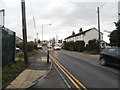
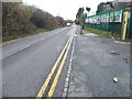
4

Footpath 19 to White Hart Lane
See the other end at Image
Image: © Glyn Baker
Taken: 24 Apr 2026
0.03 miles
5
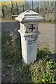
Old Boundary Marker by Collier Row Road, Romford parish
Coal Tax Marker by the UC road, in parish of Romford (Havering District), Collier Row Road, in grounds of Abbey Care Home.
To be surveyed
Milestone Society National ID: EX_CTROM04bm
Image: © Milestone Society
Taken: Unknown
0.03 miles
6
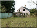
Footpath towards Collier Row Road
The end of the fields part and the start of the final narrow alley. The approach to the stile, although it doesn't show, was extremely soggy. A pond is mapped beyond the fence on the left, and there was some water feature in the garden of the house. One or the other, or both, was leaking.
Image: © Robin Webster
Taken: 8 Apr 2013
0.04 miles
7
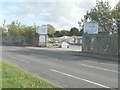
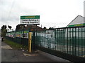
Redbridge Recycling, Collier Row Road
There are "for sale" notices either side of the entrance; the one on the right bears the information that the site is 8 acres.
Image: © John Baker
Taken: 17 Oct 2013
0.05 miles
8
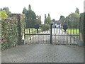
The entrance gates to Walpole Manor
Seen from Collier Row Road.
Image: © John Baker
Taken: 17 Oct 2013
0.09 miles
9
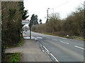
Borough boundary on Collier Row Road
The sign announces the London Borough of Barking and Dagenham. This side, the London Borough is Havering.
Image: © Robin Webster
Taken: 8 Apr 2013
0.10 miles
10
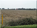
Ploughed field south of Romford Road (B174)
The bus in the distance is on the A1112, Whalebone Lane North.
Image: © Robin Webster
Taken: 8 Apr 2013
0.16 miles