IMAGES TAKEN NEAR TO
Sedgefield Crescent, ROMFORD, RM3 9RL

Introduction

This page details the photographs taken nearby to Sedgefield Crescent, RM3 9RL by members of the Geograph project.

The Geograph project started in 2005 with the aim of publishing, organising and preserving representative images for every square kilometre of Great Britain, Ireland and the Isle of Man.

There are currently over 7.5m images from over14,400 individuals and you can help contribute to the project by visiting https://www.geograph.org.uk

Image Map


Images are licensed for reuse under creativecommons.org/licenses/by-sa/2.0
Notes
  • Clicking on the map will re-center to the selected point.
  • The higher the marker number, the further away the image location is from the centre of the postcode.

Image Listing (5 Images Found)

Images are licensed for reuse under creativecommons.org/licenses/by-sa/2.0
Image
Details
Distance
1
Dagnam Park Pond
This is one of several ornamental ponds in Dagnam Park. See the view in the other direction at Image
Image: © Glyn Baker Taken: 6 May 2010
0.14 miles
2
Havering College, Tring Gardens, Harold Hill, Essex
This is the Quarles Annex of the college
Image: © John Winfield Taken: 13 Jun 2005
0.14 miles
3
Pond in Dagnam Park
This is one of several ornamental ponds in Dagnam Park See the view in the other direction at Image
Image: © Glyn Baker Taken: 6 May 2010
0.18 miles
4
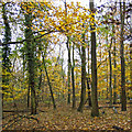
Hatter's Wood, The Manor Nature Reserve, Harold Hill
Image: © Roger Jones Taken: 20 Nov 2016
0.20 miles
5
Harold Hill: Luton House, Lindfield Road
Luton House is one of nineteen similar housing blocks on the estate north of Dagnam Park Drive, all named after towns in England and Wales. The names of all 19 in alphabetical order are:- Camelford Epsom Gillingham Glossop Halifax Haslingden Luton Lynmouth Macclesfield Minehead Morecambe Nantwich Nelson Newmarket Northampton Portmadoc Thrapston Wilmslow Wolverton Quite what the connection is between these 19 is anyone's guess!
Image: © Nigel Cox Taken: 26 Aug 2013
0.25 miles