IMAGES TAKEN NEAR TO
Tilbury Docks, TILBURY, RM18 7SG
Introduction
This page details the photographs taken nearby to Tilbury Docks, RM18 7SG by members of the Geograph project.
The Geograph project started in 2005 with the aim of publishing, organising and preserving representative images for every square kilometre of Great Britain, Ireland and the Isle of Man.

There are currently over 7.5m images from over14,400 individuals and you can help contribute to the project by visiting https://www.geograph.org.uk
Image Map
Images are licensed for reuse under creativecommons.org/licenses/by-sa/2.0
Notes
- Clicking on the map will re-center to the selected point.
- The higher the marker number, the further away the image location is from the centre of the postcode.
Image Listing (93 Images Found)
Images are licensed for reuse under creativecommons.org/licenses/by-sa/2.0
Image
Details
Distance
3

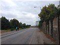
Small wooded area on Ferry Road, East Tilbury
Image: © David Howard
Taken: 22 Oct 2023
0.05 miles
4
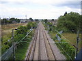
Tilbury: railway lines
Looking towards Tilbury Town railway station from the Hairpin Bridge, with Tilbury Docks beyond the fence to the left. The Hairpin Bridge is now only a pedestrian footbridge, but at one time there was a major road bridge here which provided one of the main vehicular routes into the docks.
Image: © Nigel Cox
Taken: 11 Aug 2006
0.06 miles
5

Railway near Tilbury
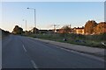
Parallel to the A1089 St Andrews Road, runs the railway to East Tilbury and then onwards to Pitsea.
On the far right is a footbridge over the railway.
Image: © David Anstiss
Taken: 16 Oct 2012
0.06 miles

7
Ferry Road, Tilbury
The railway runs along the right.
Image: © David Howard
Taken: 22 Oct 2023
0.07 miles
8

80079 on 'Cockney Coaster', Tilbury
One of the Fenchurch Street - Shoeburyness shuttles over the bank holiday weekend. Heading in the down direction, about to pass under the original Hairpin Bridge. It is slowing for the North Curve where it will pass the site of the locomotive depot where it was allocated for its early years of existence - 33B, Tilbury.
Image: © Robin Webster
Taken: 3 May 1999
0.07 miles
9
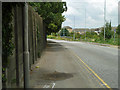
By the dock wall
This short section of St Andrews Road is the only part of this square publicly accessible on land. It features in the foreground a detected fault under the pavement - presumably electrical - but nothing has been done about it yet. A reverse view of this length of pavement and road may be seen in Image
Image: © Robin Webster
Taken: 10 Jul 2011
0.07 miles