1
Footpath in Mardyke Woods
Image: © Adrian Benn
Taken: 4 Nov 2021
0.10 miles
2
Stifford Road at Cander Way junction
There is a large post-war housing estate to the left, and some further housing to the right.
Image: © Robin Webster
Taken: 15 Sep 2011
0.11 miles
3
Gardens in Cherwell Grove
Looking from Corran Way into the back Gardens of Cherwell Grove
Image: © Glyn Baker
Taken: Unknown
0.12 miles
4
Cherwell Grove, South Ockendon
Cherwell Grove in South Ockendon.
Image: © Malc McDonald
Taken: 28 Oct 2017
0.12 miles
5
Morning Mist in Mardyke Valley
Technically the path behind the fence on the right is a permissive link for horse traffic. It follows the water meadows of the Mardyke River valley through the country park from Stifford Bridge to Ship Lane Aveley, it is not marked as a public right of way on OS Maps. Clearly walkers vote with their feet and stay to the left of the fence. The photograph was taken at the edge of Brannets Wood (the second oldest woodland in Essex) http://www.forestry.gov.uk/website/recreation.nsf/LUWebDocsByKey/EnglandEssexNoForestThamesChaseCommunityForestMardykeWoods looking towards the A13/M25 interchange.
Image: © Glyn Baker
Taken: 18 Aug 2005
0.13 miles
6
Grays and Tilbury Docks from the air
South Ockendon is at the bottom of the photo, with Thurrock across the A13 dual carriageway. Gravesend is visible across the Thames. Viewed from a Prague bound flight from Heathrow.
Image: © Thomas Nugent
Taken: 10 Apr 2011
0.14 miles
7
The Edge of Brannets Wood
Mardike Valley Country Park with Brannets Wood to the left. The fenced area between the meadow and the wood is a permissive bridleway.
Image: © Glyn Baker
Taken: 10 Jan 2010
0.15 miles
8
Primula vulgaris
These Primroses are in Brannets Wood part of Thames Chase http://www.thameschase.org.uk/what.html
Image: © Glyn Baker
Taken: 10 Apr 2007
0.15 miles
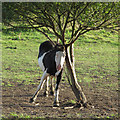
9
Scratching an itch
A horse scratches itself against a tree in Mardyke Valley. Seen from Mardyke Way.
Image: © Roger Jones
Taken: 8 Sep 2012
0.16 miles
10
Shops on Broxburn Drive, South Ockendon
A parade of shops with flats above, on Broxburn Drive in South Ockendon.
Image: © Malc McDonald
Taken: 28 Oct 2017
0.17 miles


