IMAGES TAKEN NEAR TO
Hall Lane, UPMINSTER, RM14 1TX
Introduction
This page details the photographs taken nearby to Hall Lane, RM14 1TX by members of the Geograph project.
The Geograph project started in 2005 with the aim of publishing, organising and preserving representative images for every square kilometre of Great Britain, Ireland and the Isle of Man.

There are currently over 7.5m images from over14,400 individuals and you can help contribute to the project by visiting https://www.geograph.org.uk
Image Map
Images are licensed for reuse under creativecommons.org/licenses/by-sa/2.0
Notes
- Clicking on the map will re-center to the selected point.
- The higher the marker number, the further away the image location is from the centre of the postcode.
Image Listing (15 Images Found)
Images are licensed for reuse under creativecommons.org/licenses/by-sa/2.0
Image
Details
Distance
3
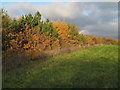
Pages Wood
At 183 acres Pages Wood is the largest new Forestry Commission planting in Thames Chase http://www.thameschase.org.uk/. The park covers two former farms Mount Pleasant and Pages Farm.
Image: © Glyn Baker
Taken: 30 Nov 2008
0.10 miles
5
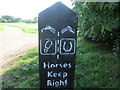
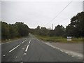
Horses keep right sign
On the London Loop between Harold Wood and Upminster Bridge.
Image: © Peter S
Taken: 1 Sep 2018
0.13 miles
6
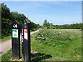
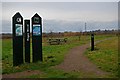
Entrance to Pages Wood
Pages Wood is the largest Forestry Commission site in the Thames Chase Community Forest. It opened in 2002 and since then 100,000 trees have been planted. This is the entrance from the car park in Hall Lane. The path is part of the London LOOP.
Image: © Marathon
Taken: 14 Jun 2017
0.14 miles
7
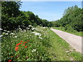
Path in Pages Wood
Pages Wood is the largest Forestry Commission site in the Thames Chase Community Forest. It opened in 2002 and since then 100,000 trees have been planted. This is the approach from the car park in Hall Lane. The path is part of the London LOOP.
Image: © Marathon
Taken: 14 Jun 2017
0.14 miles
8

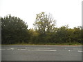
View from Hall Lane
The A127 (Southend Arterial Road) runs beyond the left hand side of this field. The London LOOP follows Hall Lane here before turning along the far side of this strip of woodland - see http://www.geograph.org.uk/photo/5430497
Image: © Marathon
Taken: 14 Jun 2017
0.16 miles
9
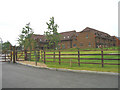
New 'gated' housing development, Hall Lane, Upminster
Image: © John Winfield
Taken: 16 Jun 2005
0.18 miles
10
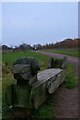
Woody Woodpecker?
This seat in Pages Wood is a one of a number of sculptures around the park designed by local school children
Image: © Glyn Baker
Taken: 30 Nov 2008
0.18 miles