IMAGES TAKEN NEAR TO
Caernarvon Close, HORNCHURCH, RM11 3QL
Introduction
This page details the photographs taken nearby to Caernarvon Close, RM11 3QL by members of the Geograph project.
The Geograph project started in 2005 with the aim of publishing, organising and preserving representative images for every square kilometre of Great Britain, Ireland and the Isle of Man.

There are currently over 7.5m images from over14,400 individuals and you can help contribute to the project by visiting https://www.geograph.org.uk
Image Map
Images are licensed for reuse under creativecommons.org/licenses/by-sa/2.0
Notes
- Clicking on the map will re-center to the selected point.
- The higher the marker number, the further away the image location is from the centre of the postcode.
Image Listing (53 Images Found)
Images are licensed for reuse under creativecommons.org/licenses/by-sa/2.0
Image
Details
Distance
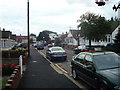
3
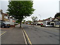
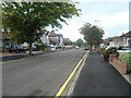
Minster Way, Hornchurch
Looking north west.
Image: © JThomas
Taken: 11 May 2019
0.11 miles
4
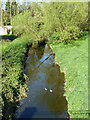
Two drakes on the Ingrebourne
Viewed from the Berkeley Drive bridge.
Image: © Robin Webster
Taken: 9 Apr 2011
0.13 miles
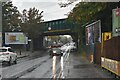
9
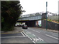
Railway bridge over Upminster Road (A124)
Used by the London Underground.
Image: © JThomas
Taken: 11 May 2019
0.16 miles
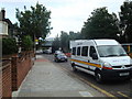
10
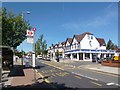
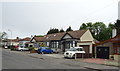
Outside Upminster Bridge Station
Shops on Upminster Road opposite the District Line station.
Image: © Des Blenkinsopp
Taken: 4 Jun 2013
0.16 miles