
IMAGES TAKEN NEAR TO
Queens Road, HORLEY, RH6 7AJ
Introduction
This page details the photographs taken nearby to Queens Road, RH6 7AJ by members of the Geograph project.
The Geograph project started in 2005 with the aim of publishing, organising and preserving representative images for every square kilometre of Great Britain, Ireland and the Isle of Man.

There are currently over 7.5m images from over14,400 individuals and you can help contribute to the project by visiting https://www.geograph.org.uk
Image Map
Images are licensed for reuse under creativecommons.org/licenses/by-sa/2.0
Notes
- Clicking on the map will re-center to the selected point.
- The higher the marker number, the further away the image location is from the centre of the postcode.
Image Listing (100 Images Found)
Images are licensed for reuse under creativecommons.org/licenses/by-sa/2.0
Image
Details
Distance
1

Corner eating places, Horley
Three different food outlets at the corner of Church Road and Victoria Road. Opposite, Ruffles is the exception - it is a stationers.
Image: © Robin Webster
Taken: 25 Mar 2010
0.06 miles
2
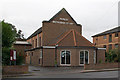
Horley Methodist Church
Built in 1960, the church having outgrown its previous premises.
Image: © Ian Capper
Taken: 9 Oct 2011
0.06 miles
3
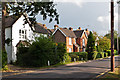
Church Road, Horley
Edwardian houses in Church Road. As the name suggests, the road leads to the church (St Bartholomews - see Image). However the road was cut in two by, and this end bypassed by, the building of Thorns Road (now Brighton Road) in 1816, as part of the new Gatton to Povey Cross turnpike. As a result, this section of Church Road is now a quiet residential road.
Image: © Ian Capper
Taken: 21 Aug 2012
0.07 miles
4
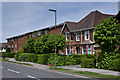
Victoria Road
One of the original Edwardian houses dating form when this road was first developed, alongside modern flats in Elizabeth Court.
Image: © Ian Capper
Taken: 26 May 2013
0.07 miles
5
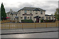
The Air Balloon
A pub has been on this site since at least 1785, originally known as The Thorns, predating the building of what is now Brighton Road (originally Thorns Road), built in 1816 as part of the new Gatton to Povey Cross turnpike. Over the years it saw much redevelopment and expansion, with its position on what was originally the main London-Brighton road making it popular with weekend traffic.
In 1982 it was renovated and renamed The Game Bird. Over the years it developed a poor reputation, and it was closed in the 1990s. It reopened in 1995 as The Air Balloon, with a "Wacky Warehouse" next door, as a popular children's venue.
The building is locally listed.
Image: © Ian Capper
Taken: 9 Oct 2011
0.09 miles
6
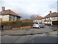
Victoria Close at the junction of Victoria Road
Image: © David Howard
Taken: 29 Mar 2015
0.10 miles
7
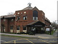
Horley Health Centre
New Health Centre opened in 2007
Image: © Richard Rogerson
Taken: 17 Feb 2009
0.10 miles
8
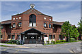
The Health Centre
Situated at the junction of Kings Road with Victoria Road and housing the Birchwwod Medical Practice, which has been operating form here since 2005.
Image: © Ian Capper
Taken: 26 May 2013
0.10 miles
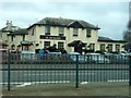
10
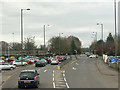
A23 Brighton Road, Horley
The crossroads by the Air Balloon pub, out of sight to the right.
Image: © Robin Webster
Taken: 23 Mar 2019
0.11 miles