IMAGES TAKEN NEAR TO
Stane Street, DORKING, RH5 5TQ
Introduction
This page details the photographs taken nearby to Stane Street, RH5 5TQ by members of the Geograph project.
The Geograph project started in 2005 with the aim of publishing, organising and preserving representative images for every square kilometre of Great Britain, Ireland and the Isle of Man.

There are currently over 7.5m images from over14,400 individuals and you can help contribute to the project by visiting https://www.geograph.org.uk
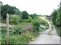
Image Map
Images are licensed for reuse under creativecommons.org/licenses/by-sa/2.0
Notes
- Clicking on the map will re-center to the selected point.
- The higher the marker number, the further away the image location is from the centre of the postcode.
Image Listing (37 Images Found)
Images are licensed for reuse under creativecommons.org/licenses/by-sa/2.0
Image
Details
Distance
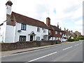
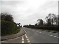
2
Development on Stane Street
Cottages are being developed on the site of the erstwhile public house which had been the old school house.
See also http://www.geograph.org.uk/photo/1221189.
Image: © Shazz
Taken: 15 Apr 2017
0.02 miles
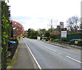
4
The Old School House
Home to the acclaimed Bryce's Fresh Seafood & Fish Restaurant http://www.bryces.co.uk/. The 1879 OS map shows the National School on the green to the north so I don't know when this was a school.
Image: © Andy Potter
Taken: 9 Jan 2009
0.03 miles


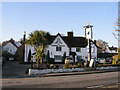
10
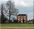
Old Rectory, Ockley
Late C18th or early C19th house in three bays and storeys. Grade II listed.
Image: © Stephen Richards
Taken: 6 Apr 2015
0.08 miles