IMAGES TAKEN NEAR TO
Chart Downs, DORKING, RH5 4DH
Introduction
This page details the photographs taken nearby to Chart Downs, RH5 4DH by members of the Geograph project.
The Geograph project started in 2005 with the aim of publishing, organising and preserving representative images for every square kilometre of Great Britain, Ireland and the Isle of Man.

There are currently over 7.5m images from over14,400 individuals and you can help contribute to the project by visiting https://www.geograph.org.uk
Image Map
Images are licensed for reuse under creativecommons.org/licenses/by-sa/2.0
Notes
- Clicking on the map will re-center to the selected point.
- The higher the marker number, the further away the image location is from the centre of the postcode.
Image Listing (32 Images Found)
Images are licensed for reuse under creativecommons.org/licenses/by-sa/2.0
Image
Details
Distance
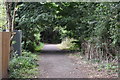
1
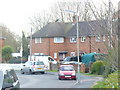
Chart Gardens
Residential housing estate in south Dorking. It looks like a council-built estate.
Image: © Colin Smith
Taken: 7 Mar 2009
0.04 miles
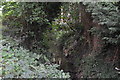
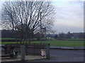
2
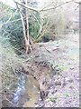
Bents Brook
Mole tributary, passing by housing developments in southern Dorking. The steep, sandy winding banks are about 3 feet deep.
Image: © Colin Smith
Taken: 7 Mar 2009
0.06 miles
4
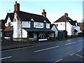
Royal Oak Pub
Chart Lane South, Dorking.
Image: © Martyn Davies
Taken: 11 Jan 2006
0.06 miles
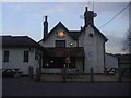
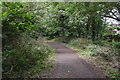
8
Exit from the Royal Oak car park, Stonebridge
Image: © David Howard
Taken: 30 Jan 2012
0.08 miles
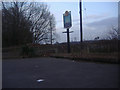
9
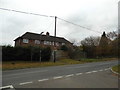
Chart Lane South at the junction with Punchbowl Lane
Image: © David Howard
Taken: 27 Nov 2016
0.09 miles