
IMAGES TAKEN NEAR TO
Cleardene, DORKING, RH4 2BY
Introduction
This page details the photographs taken nearby to Cleardene, RH4 2BY by members of the Geograph project.
The Geograph project started in 2005 with the aim of publishing, organising and preserving representative images for every square kilometre of Great Britain, Ireland and the Isle of Man.

There are currently over 7.5m images from over14,400 individuals and you can help contribute to the project by visiting https://www.geograph.org.uk
Image Map
Images are licensed for reuse under creativecommons.org/licenses/by-sa/2.0
Notes
- Clicking on the map will re-center to the selected point.
- The higher the marker number, the further away the image location is from the centre of the postcode.
Image Listing (268 Images Found)
Images are licensed for reuse under creativecommons.org/licenses/by-sa/2.0
Image
Details
Distance
1
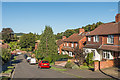
Cleardene
Cul-de-sac off Chart Lane (the road in the background). Although more recent in appearance, the development is on the 1934 revision of the 6" map, suggesting a 1920s or early 1930s building date.
Image: © Ian Capper
Taken: 11 Sep 2016
0.01 miles
2
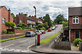
Cleardene
Cul-de-sac off Chart Lane. Although more recent in appearance, the development is on the 1934 revision of the 6" map, suggesting a 1920s or early 1930s building date.
Image: © Ian Capper
Taken: 11 Jun 2016
0.01 miles
3
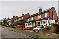
Cleardene
Cul-de-sac off Chart Lane. Although more recent in appearance, the development is on the 1934 revision of the 6" map, suggesting a 1920s or early 1930s building date.
Image: © Ian Capper
Taken: 24 Sep 2016
0.02 miles
4
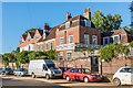
Cotmandene Lodge
Large house on Dene Street in four sections dating originally from the early 18th Century with later additions. Grade II listed - see https://www.historicengland.org.uk/listing/the-list/list-entry/1227739.
Image: © Ian Capper
Taken: 11 Sep 2016
0.05 miles
5
Cotmandene
A small common close to the centre of Dorking
Image: © Martyn Davies
Taken: Unknown
0.05 miles
6
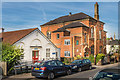
CAMHS and Dene Street Centre, Dene Street
The building on the left houses the Child & Adolescent Mental Health Service (CAMHS).
That on the right is the Dene Street Centre. This was built in 1872 as the Chart Lane Institute, provided by John Evelyn of Wotton Place as a facility for working men. In 1892, it became the home of the Dorking Boy's High School which remained there until it moved to the premises of the present Ashcombe School in 1931. It later became the Dorking Institute of Further Education, an adult learning centre, before closure in around 2011. Plans are in place for conversion to flats.
Image: © Ian Capper
Taken: 24 Sep 2016
0.06 miles
7
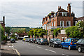
Dene Street
Looking north along Dene Street. On the right is Cotmandene Lodge, a large house in four sections dating originally from the early 18th Century with later additions. Grade II listed - see https://www.historicengland.org.uk/listing/the-list/list-entry/1227739. See Image] for closer view.
Image: © Ian Capper
Taken: 11 Jun 2016
0.06 miles
8
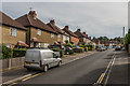
Beresford Road
Estate built for the then Dorking Urban District Council in 1927-8.
Image: © Ian Capper
Taken: 24 Sep 2016
0.06 miles
9
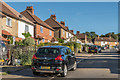
Beresford Road
Estate built for the then Dorking Urban District Council in 1927-8.
Image: © Ian Capper
Taken: 11 Sep 2016
0.06 miles
10
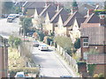
Marlborough Road
Residential road in south Dorking, climbing up Rose Hill from Cotmandene.
Image: © Colin Smith
Taken: 7 Mar 2009
0.06 miles