
IMAGES TAKEN NEAR TO
Ansell Road, DORKING, RH4 1GT
Introduction
This page details the photographs taken nearby to Ansell Road, RH4 1GT by members of the Geograph project.
The Geograph project started in 2005 with the aim of publishing, organising and preserving representative images for every square kilometre of Great Britain, Ireland and the Isle of Man.

There are currently over 7.5m images from over14,400 individuals and you can help contribute to the project by visiting https://www.geograph.org.uk
Image Map
Images are licensed for reuse under creativecommons.org/licenses/by-sa/2.0
Notes
- Clicking on the map will re-center to the selected point.
- The higher the marker number, the further away the image location is from the centre of the postcode.
Image Listing (600 Images Found)
Images are licensed for reuse under creativecommons.org/licenses/by-sa/2.0
Image
Details
Distance
1
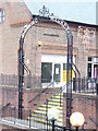
Dorking Market Arch
Historic metal arch, relocated from the High Street to modern, pedestrianized St Martin's Square.
Image: © Colin Smith
Taken: 16 Nov 2008
0.01 miles
2
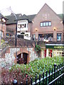
St Martin's Square
Modern pedestrianized shopping centre on the north side of Dorking's High Street. It conveniently is adjacent to a car park. The metal arch is a remnant from the former Dorking Market.
Image: © Colin Smith
Taken: 16 Nov 2008
0.01 miles
5
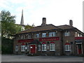
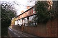
Malthouse, Dorking, Surrey
This pub is located at the end of Mill Lane.
As I was taking this photograph, I was spotted by some members of a walking group who left Holmwood Station at the same time as myself.
Image: © Peter Trimming
Taken: 16 Jul 2009
0.04 miles
6
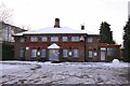
The Malthouse
The Malthouse, seen here Image eighteen months earlier, now boarded up. A proposal from Sainsbury's would see the redevelopment of this site and land to the west.
Image: © Hugh Craddock
Taken: 26 Dec 2010
0.04 miles
7
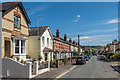
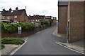
Hart Road
Late Victorian housing in a street running parallel with and north of High Street, with Box Hill in the distance.
Image: © Ian Capper
Taken: 11 Aug 2017
0.05 miles
10
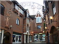
St Martin's Walk
Modern pedestrianized shopping street on the north side of Dorking's High Street. The Christmas lights are on.
Image: © Colin Smith
Taken: 16 Nov 2008
0.05 miles