IMAGES TAKEN NEAR TO
Lincoln Road, DORKING, RH4 1GP

Introduction

This page details the photographs taken nearby to Lincoln Road, RH4 1GP by members of the Geograph project.

The Geograph project started in 2005 with the aim of publishing, organising and preserving representative images for every square kilometre of Great Britain, Ireland and the Isle of Man.

There are currently over 7.5m images from over14,400 individuals and you can help contribute to the project by visiting https://www.geograph.org.uk

Image Map


Images are licensed for reuse under creativecommons.org/licenses/by-sa/2.0
Notes
  • Clicking on the map will re-center to the selected point.
  • The higher the marker number, the further away the image location is from the centre of the postcode.

Image Listing (198 Images Found)

Images are licensed for reuse under creativecommons.org/licenses/by-sa/2.0
  • ...
Image
Details
Distance
1
Vista House
The former Federated House, built in 1965 and until closure serving as the Highways Agency regional office. It has now been converted into flats, a project completed in 2018 - see Image
Image: © Ian Capper Taken: 16 Sep 2018
0.01 miles
2
Federated House
Former Highways Agency regional office, built in 1965. It is currently undergoing conversion to 71 residential units by local company Stonegate Homes.
Image: © Ian Capper Taken: 10 Oct 2016
0.01 miles
3
Vista House
The former Federated House, built in 1965 and until closure serving as the Highways Agency regional office. It has now been converted into flats, a project completed in 2018 - see Image
Image: © Ian Capper Taken: 16 Sep 2018
0.01 miles
4
Lincoln Road
Late Victorian housing. The road itself is already shown on the 1870 1:2500 map, with the area between it and the Redhill - Guildford railway at Deepdene (then Boxhill) Station (the side of the road seen here) shown as a nursery garden, named Boxhill Nursery. The houses first appear on the 1896 1:2500 map. In the background is Ashcombe, one of a number of large villas built on the stretch of London Road between Lincoln Road and the railway at around the same time.
Image: © Ian Capper Taken: 10 Oct 2016
0.03 miles
5
Dorking Deepdene Station
Image: © N Chadwick Taken: 7 Feb 2015
0.03 miles
6
Deepdene station, Dorking
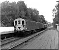
The rear end of '3-R' (or 'Tadpole') unit is seen as it departs for Redhill. The rear car is a 'DMBSO' (Driving Motor Brake Second Open); the inverted black triangle indicates to station staff that there is no brake compartment at the other end of the unit.
Image: © Dr Neil Clifton Taken: 18 Jul 1979
0.03 miles
7
Deepdene station, Dorking
A 'Class 119' three-car diesel mechanical unit, No L574, runs into Deepdene station on a service to Reading. This is a Western Region unit, and the 'L' indicates that it is based in the London area. These units were built by the Gloucester Railway Carriage and Wagon company, and being designed for longer distance, rather than suburban, work, they were more comfortable and, not surprisingly, were popular with the passengers.
Image: © Dr Neil Clifton Taken: 18 Jul 1979
0.03 miles
8
Dorking Deepdene Station
Image: © N Chadwick Taken: 23 Jan 2011
0.03 miles
9
Dorking Deepdene Station
Image: © N Chadwick Taken: 28 Aug 2019
0.03 miles
10
Train at Deepdene Station
One of Dorking's two segregated stations. This one, Deepdene, is for east-west journeys. The other station is about 250 metres away and is for north-south travellers. You have to walk between them. Considering what feats of engineering the railway builders were capable of, you would have thought they might have put a dual level station at the crossover. But they didn't.
Image: © Des Blenkinsopp Taken: 12 Aug 2024
0.03 miles
  • ...