Deepdene station, Dorking
Introduction
The photograph on this page of Deepdene station, Dorking by Dr Neil Clifton as part of the Geograph project.
The Geograph project started in 2005 with the aim of publishing, organising and preserving representative images for every square kilometre of Great Britain, Ireland and the Isle of Man.

There are currently over 7.5m images from over 14,400 individuals and you can help contribute to the project by visiting https://www.geograph.org.uk
Deepdene station, Dorking
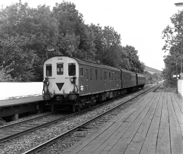
Image: © Dr Neil Clifton Taken: 18 Jul 1979
The rear end of '3-R' (or 'Tadpole') unit is seen as it departs for Redhill. The rear car is a 'DMBSO' (Driving Motor Brake Second Open); the inverted black triangle indicates to station staff that there is no brake compartment at the other end of the unit.
Images are licensed for reuse under creativecommons.org/licenses/by-sa/2.0
Image Location
Latitude
51.238792
Longitude
-0.323942