IMAGES TAKEN NEAR TO
Gadbrook Road, BETCHWORTH, RH3 7AN
Introduction
This page details the photographs taken nearby to Gadbrook Road, RH3 7AN by members of the Geograph project.
The Geograph project started in 2005 with the aim of publishing, organising and preserving representative images for every square kilometre of Great Britain, Ireland and the Isle of Man.

There are currently over 7.5m images from over14,400 individuals and you can help contribute to the project by visiting https://www.geograph.org.uk
Image Map
Images are licensed for reuse under creativecommons.org/licenses/by-sa/2.0
Notes
- Clicking on the map will re-center to the selected point.
- The higher the marker number, the further away the image location is from the centre of the postcode.
Image Listing (13 Images Found)
Images are licensed for reuse under creativecommons.org/licenses/by-sa/2.0
Image
Details
Distance
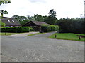
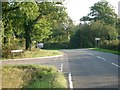
2
Gadbrook Crossroads
A staggered crossroads now (off to the left), but evidently once a true crossroads, there is a stub of the old alignment visible behind the direction signs.
Image: © Robin Webster
Taken: 24 Apr 2021
0.06 miles
3
Shellwood Road
At Brockhurst Road (left) and Gadhurst Road (ahead right).
Image: © Oast House Archive
Taken: 6 Aug 2011
0.06 miles
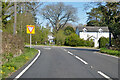
5
Junction of Middle Street with Gadbrook Road (left)
Looking south. The former crossroads here has been changed to a staggered junction; Brockhamhurst Road is to the right.
Image: © Andrew Longton
Taken: 20 Sep 2005
0.09 miles
6
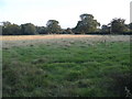
Field by Brockhamhurst Road, Blackbrook
Image: © David Howard
Taken: 22 Sep 2014
0.12 miles
7
Field by Brockhamhurst Road, Blackbrook
Image: © David Howard
Taken: 22 Sep 2014
0.12 miles
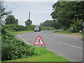
8
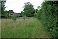
Footpath to Gadbrook Road
The landowner has mown the start of the path, to indicate the way he wants people to go, but few seem to have used this route.
Image: © Robin Webster
Taken: 11 Jul 2010
0.18 miles
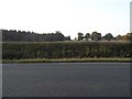
9
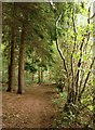
Path at the margin of High Ridge Wood
This south-east portion of High Ridge Wood is largely conifer plantation - screened from adjacent farmland by coppiced hazels.
Image: © Stefan Czapski
Taken: 7 Oct 2013
0.19 miles
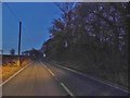
10
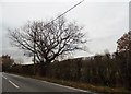
Bunce Common Road
Been there, done that http://www.geograph.org.uk/photo/4176919
Image: © David Howard
Taken: 27 Nov 2016
0.22 miles