IMAGES TAKEN NEAR TO
Ironsbottom, REIGATE, RH2 8PR
Introduction
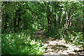
This page details the photographs taken nearby to Ironsbottom, RH2 8PR by members of the Geograph project.
The Geograph project started in 2005 with the aim of publishing, organising and preserving representative images for every square kilometre of Great Britain, Ireland and the Isle of Man.

There are currently over 7.5m images from over14,400 individuals and you can help contribute to the project by visiting https://www.geograph.org.uk
Image Map
Images are licensed for reuse under creativecommons.org/licenses/by-sa/2.0
Notes
- Clicking on the map will re-center to the selected point.
- The higher the marker number, the further away the image location is from the centre of the postcode.
Image Listing (15 Images Found)
Images are licensed for reuse under creativecommons.org/licenses/by-sa/2.0
Image
Details
Distance
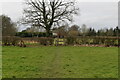
3
Private keep out at Tamworth Farm
An alpaca keeps an eye out for trespassers.
Image: © Robin Webster
Taken: 10 Jul 2010
0.15 miles
5
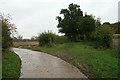
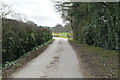
Public bridleway to Deanoak Bridge
Public bridleway Salfords & Sidlow 424 branches off to the right down a short green lane, before arriving at the farm drive to Stumblehole. Public footpath Salfords & Sidlow 422a follows the concrete drive round to the left, towards Bures Manor and Irons Bottom. The borough boundary between Reigate and Banstead and Mole Valley here follows the middle of the green lane.
Image: © Hugh Craddock
Taken: 1 Nov 2008
0.16 miles