
IMAGES TAKEN NEAR TO
Park Lane East, REIGATE, RH2 8HW
Introduction
This page details the photographs taken nearby to Park Lane East, RH2 8HW by members of the Geograph project.
The Geograph project started in 2005 with the aim of publishing, organising and preserving representative images for every square kilometre of Great Britain, Ireland and the Isle of Man.

There are currently over 7.5m images from over14,400 individuals and you can help contribute to the project by visiting https://www.geograph.org.uk
Image Map
Images are licensed for reuse under creativecommons.org/licenses/by-sa/2.0
Notes
- Clicking on the map will re-center to the selected point.
- The higher the marker number, the further away the image location is from the centre of the postcode.
Image Listing (75 Images Found)
Images are licensed for reuse under creativecommons.org/licenses/by-sa/2.0
Image
Details
Distance
1
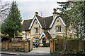
Parkside
Mid 19th Century house on Park Lane East, built out of Reigate stone, now divided into two sections. Locally listed.
Image: © Ian Capper
Taken: 10 Jan 2020
0.01 miles
2
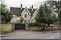
Parkside
Mid 19th Century house on Park Lane East, built out of Reigate stone, now divided into two sections. Locally listed.
Image: © Ian Capper
Taken: 10 Jan 2020
0.01 miles
3
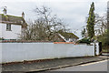
Cockshut and Cockshut Cottage
Houses on Park Lane East. On the left is part of Cockshut, built around 1800, and on the right is the roof of Cockshut Cottage, built in the early 19th Century. Both are grade II listed - see www.historicengland.org.uk/listing/the-list/list-entry/1029097 and www.historicengland.org.uk/listing/the-list/list-entry/1188855 respectively.
Image: © Ian Capper
Taken: 10 Jan 2020
0.05 miles
4
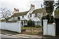
Cockshut
House on Park Lane East, built around 1800. Old maps show it named as Bellevue. Grade II listed - see www.historicengland.org.uk/listing/the-list/list-entry/1029097.
Image: © Ian Capper
Taken: 10 Jan 2020
0.06 miles
5
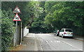
Park Lane East - Steep Hill 10%
Park Lane East, Reigate. 10% steep hill down sign.
Image: © Adam Morse
Taken: 12 Jul 2009
0.06 miles
6
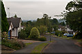
Priory Drive
1970s(?) development off Park Lane East. In the far distance is Gatwick Airport.
Image: © Ian Capper
Taken: 1 Sep 2012
0.06 miles
7

Cockshut
House on Park Lane East, built around 1800. Old maps show it named as Bellevue. Grade II listed - see www.historicengland.org.uk/listing/the-list/list-entry/1029097.
Image: © Ian Capper
Taken: 10 Jan 2020
0.06 miles
8
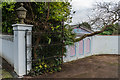
Outbuilding, Cockshut
Ornate outbuilding on the drive of Cockshut, a house on Park Lane East, built around 1800 - see Image
Image: © Ian Capper
Taken: 10 Jan 2020
0.07 miles
9
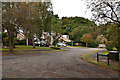
Randal Crescent
Despite its name, this short road off Priory Drive is not a crescent but a cul de sac. Were original plans for a longer road?
The road name commemorates Randal Vogan, local benefactor (see Image).
Image: © Ian Capper
Taken: 1 Sep 2012
0.10 miles
10
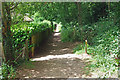
Footpath junction, Reigate Park
Straight on is the footpath following the southern boundary of the park, at the left is a short connection dropping down to the residential close of Seale Hill.
Image: © Robin Webster
Taken: 1 Jul 2010
0.11 miles