IMAGES TAKEN NEAR TO
Barons Way, REIGATE, RH2 8EU
Introduction
This page details the photographs taken nearby to Barons Way, RH2 8EU by members of the Geograph project.
The Geograph project started in 2005 with the aim of publishing, organising and preserving representative images for every square kilometre of Great Britain, Ireland and the Isle of Man.

There are currently over 7.5m images from over14,400 individuals and you can help contribute to the project by visiting https://www.geograph.org.uk
Image Map
Images are licensed for reuse under creativecommons.org/licenses/by-sa/2.0
Notes
- Clicking on the map will re-center to the selected point.
- The higher the marker number, the further away the image location is from the centre of the postcode.
Image Listing (44 Images Found)
Images are licensed for reuse under creativecommons.org/licenses/by-sa/2.0
Image
Details
Distance
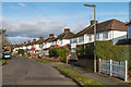
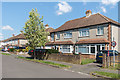
1
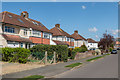
Baron's Way
Housing in an area that started to be developed in the 1930s.
Image: © Ian Capper
Taken: 18 Apr 2015
0.02 miles
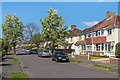
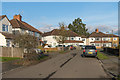
2
Hartswood Avenue
Housing in an area that started to be developed in the 1930s. This is Hartswood Avenue, with Baron's Way on the right.
Image: © Ian Capper
Taken: 18 Apr 2015
0.04 miles
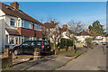
3
Hartswood Avenue
Housing in an area that started to be developed in the 1930s.
Image: © Ian Capper
Taken: 18 Apr 2015
0.06 miles
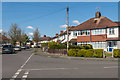
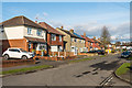
4
Sandcross Lane
Formerly a country lane marked on early 19th century maps, development of this area, including this road, started in the 1930s.
Image: © Ian Capper
Taken: 1 Feb 2014
0.06 miles
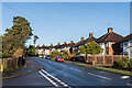
5
Hitchings Way
Housing in an area that started to be developed in the 1930s.
Image: © Ian Capper
Taken: 17 Feb 2017
0.08 miles
6
Matthews Street
Housing in an area that started to be developed in the 1930s.
Image: © Ian Capper
Taken: 17 Feb 2017
0.08 miles
7
Matthews Street
Housing in an area that started to be developed in the 1930s.
Image: © Ian Capper
Taken: 17 Feb 2017
0.09 miles
8
Hitchings Way
Housing in an area that started to be developed in the 1930s.
Image: © Ian Capper
Taken: 17 Feb 2017
0.11 miles
9
Hitchings Way
Housing in an area that started to be developed in the 1930s.
Image: © Ian Capper
Taken: 18 Apr 2015
0.12 miles
10
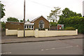
Sandcross Lane Church
Originally founded during the Second World War as a mission church to the children of Woodhatch. The present site was bought in 1947 and a wooden hut built for services. The present building was built 10 years later.
Image: © Ian Capper
Taken: 27 May 2008
0.12 miles